| |
| |
Snowman's Hill s(u)
Gigantic Mount Shasta has populated slopes. One side is climbed by an interstate highway and even the railroad. Stores, traffic and tourists all converge at the town "Mount Shasta City", with the snowy namesake looming behind. From there it's another 1000ft higher to the top of this hill, which also serves as an access road to a ski area. There two completely paved approaches on this road. But the profile below contains an unpaved SOUTH-2 approach, in order to illustrate a partially paved loop ride, that I tried.
From South 1. North of Castella
bicycles have to travel on I5 for a short
distance. Then several miles before Dunsmuire a
little traveled service road leads through a
tunnel of green with houses, hidden deep in the
shady woods. This service road on the east side
of the road seems to end at one point. But
taking a right into what looks like an RV park
on something named 1st or 2nd Ave or Street,
makes the green tunnel continue on the other
side of the river into Dunsmuire. Past this interesting collection of old houses
fronting railroad tracks, the profile stays on
the west side of I5 When looking at a map,
it seems like there is alternative approach on
the east side of I5, in the form of an old
highway. In sections this road is paved and has
a drainage ditch so wide, that it could be
mistaken for a bike lane. But it does not
continue through to Dunsmuir on pavement. We are still below Mount Shasta City on the
west side of I5. On the upper part of this
section, past another chance to ride on the
interstate instead ( - No Thank You ), the road
becomes just barely what you could call paved
and winds over every tiny wave in the landscape
to pick up every tiny driveway in the woods. The
road is now called Old Stage Road. After this
little detour loop to the west, Old Stage Rd
south comes into proximity of I5 and the
railroad again. Several crossroads lend
themselves to ride into Mount Shasta City. The
profile picks Azalea Drive. 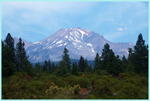 a view of Mount Shasta, while leaving Shasta City on Ca89 Exiting the town back towards the south, Mount
Shasta shows a few more pictures of itself, and
then disappears behind the trees, as Ca89 climbs
steadily and without interesting views of any
kind towards a summit. It is signed with the
name "Snowman's Hill" and the elevation. That
last part on C89 has the most traffic along the
way, but also a wide shoulder without rumble
strips. On top a road crosses. The left is paved
and leads higher up Skipark Hiway. The right is
unpaved and described as South 2 approach below. From South 2. Signs along the way warn
- or advertise - a locked gate. That's
just perfect for a peaceful bike ride. After
traversing a short section of National Forest
land, this logging road traverses through dense
forest. The road crosses another prominent dirt
road at a saddle. While the crossing road is
downhill in both directions, the one I am one is
uphill in both directions. The profile goes
downhill to the right. According to the map a
left here would lead into Castella. Continuing
to the right, there are a few great views of the
Craggs downvalley. 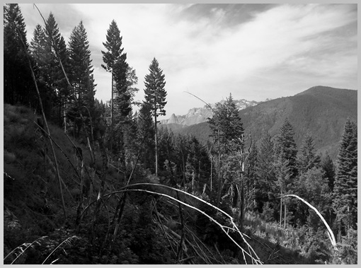 forest clear cut on unpaved South-2 approach, Castella Crags in the distance The dirt road finally ends at another gate and
a junction with a paved road and yet another
dirt road . The paved road heads north, back up
towards Mount Shasta. Continuing downvalley is
possible by following the dirt road at this
junction. It leads to a fork, forcing the choice
between two power line trails, one to the left
going steeply uphill, one to the right
apparently promising a descent into Dunsmuire.
This option even delivers what it promises, but
not without a couple of steep ups and downs. The
trail enters Dunsmuire, north of town, at the
jct with a private driveway, becoming South
Summit View Pvt Rd. Looking for this intersecion
from the other side you have to turn uphill
between Oak Tree Inn and Best Choice Inn. - It's
easier to find from the other direction - much
easier. Dayride PARTIALLY PAVED / UNPAVED ( < Lassen
National Park rd Summit | FR19 Deer
Mountain Rd s(u) > ) |
 Approaches
|
|
advertisement |
|
|
advertisement |