| |
| |
Kitt Peak(ow) One web-site, heavy with swagger
about cycling climbs, names an "Arizona
Trinity" of climbs, and this one is amongst
them. The other two are Mt Lemmon
and Mt
Graham. This one is actually the lowest
of the three. and one great thing about it is
its joyous dessert isolation, where I
experienced a perfect single shirt decent on a
very memorable November 30th.
Seems these Arizona dessert climbs
all start the same way. A road heading straight
and directly for a rocky range of mountains on
an alluvial fan. The end of the fan, an initial
tilt upwards in the road, and a right turn to
parallel the ridge marks the start of the second
stage. Here the road climbs very uniformly, soon
traversing along every ravine of what will
become Kitt Peak above. When coming from the
east or south, the dessert definitely has a more
deserted appearance here. Not a trace of a tree
below, and the mountain ranges uniformly recede
into mild haze, that only obscures the views
when the distances become immense. 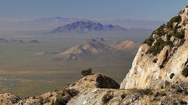
As the road works its way
southwards and the view shed shifts to include
the main ridge of the Baboquivari Mountains, a
great block of a mountain comes into sight, that
had been a landmark on practically every bike
and hike during the last two weeks, the great
Baboquivari Peak. With further climbing it also
becomes apparent that the real estate around the
peak is not limited to a single observatory, but
great bunches of them. I couldn't name a single
respectable US university, whose name was not
represented on one of the many giant garbage-can
shapes, under which these huge mirrors are
hidden. Of course the The
Very-Large-Baseline-Array, which boasts a
sharpness of being able to read a postage stamp
in New York from La is also represented. The
best views are from various out-and-backs to
numerous observatories. There are may signs
featuring a cyclist beneath a diagonal red line
on these short dead ends, but there are no
barricades.
Dayride without two way
summits and this point as highest out-and-back
summit
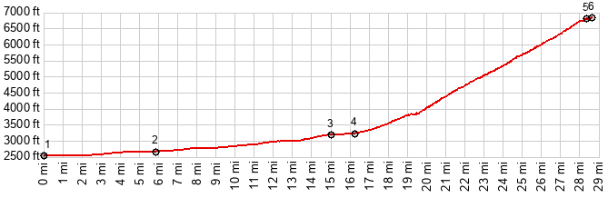
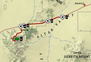
COMPLETELY PAVED: ( < Mission Rd s(u) | Gates Pass > ) just west of jct Hayhook Ranch Rd - Az86 <> Az86 west <> Az386 south << turnaround on top of Kitt Peak <> separate out and back from Az86 to Uhs Kug << turnaround point end of pavement. Also includes various short out and backs to various observatories: 54.2miles with 4750ft of climbing in5:08hrs (garmin etrex32x r4:24.11.30) 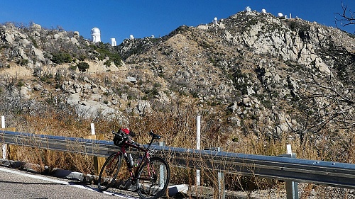 |
|
|
advertisement |
|
|
advertisement |