| |
| |
The page on this small
unimportant summit exists, just because of
some rules, that I made up on how to organize
these pages, because what good are rules if
you only follow them sometimes: One of these
rules is: Rides appear on pages with the
highest two-approach summit, under all
circumstances, even if it pales in comparison
to any one-approach (out and back) summit.
Only if there is no two-approach summit at all
on the ride, does the ride go on the page
describing the out-and back approach. The
point here is a low junction between the two
lower approach options to the Mount Hopkins
Rd. Even if it is not a big climb up to
this point. This is a very beautiful place, a
great viewing platform onto the Santa Rita
Mountains during late light.
From North.
(described downwards). The entire decent is
paved, albeit with very rough asphalt containing
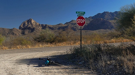
rocks. Mt Hopkins Rd merges on Elephant Head Rd,
and that is the sign to look for when looking
for this road from the I19 frontage Rd.
 Dayride with this point as
highest summit: Dayride with this point as
highest summit:PARTIALLY PAVED / UNPAVED ( < same page | FR4058 - FR231 Santa Rita Mtns s(u) > ) FR184 Mt Hopkins Rd - Amado Rd s(u) , additional out and back: partially up Amado Rd > up Amado Rd > FR184 Mt Hopkins Rd - Amado Rd s(u) > down FR184 Mt Hopkins Rd > jct with Elephant Head Rd <> out and back to various apparent dead ends on Elephant Head Rd >> down Elephant Head Rd > I19 frontage rd north > <> Continental Rd west << with turnaround point at 3840ft > lost detours in suburban dead end development near jct with I19 > I19 frontage road south > back to starting point on Amado Rd: 51.5miles with 1890ft of climbing in 4:14hrs (garmin etrex32x m6:24.11.23) Notes: If this was not the cold part of the year I would say this ride was on the verge of being too hot on this 24th November. On the way back I had a few miles in common with the 102 miles "tour de Tuscon". ( < Mule Pass | same page > ) FR184 FR184 Amado Rd - Hopkins Rd(sh) , additional out and back: a short distance on FR184 from its jct with I19 frontage Rd > up FR184 > FR184 Amado Rd - Mt Hopkins Rd(sh) <> out and back to point where road is closed on Mt Hopkins Rd(ow) >> down Mt Hopkns Rd > I19 frontage Rd south <> out and back to end of paved frontage Rd: 41.2miles with 4300ft of climbing in 4:29hrs (garmin etrex32x m6:24.11.22) Notes: The main objective was the one way summit on Mt Hopkins. I met Hans from the Netherlands and we rode the way up together on this incredibly warm day |
|
|
advertisement |
|
|
advertisement |