| |
| |
Ute Pass - Williams Fork
Range
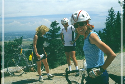
This was one of my first gravel
biking passes ever, at a time when that sort of
thing was referred to as mountain biking. So now I
come back several decades later and discover -
it's still not gravel biking, that is called for.
Sometime during these several last decades, the
road has been paved. Am I disappointed - not a
bit. This is a rare moment for a road biker
of to get away from traffic completely in
this busy area, and enjoy an isolated loop through
beautiful scenery - mostly, except for short
stretches on Co9
 Approaches From West. I am tempted to start the
profile all the way back in Kremmling. But
actually the road reaches a point as low as
Kremmling, about three miles out of town, where it
crosses Elliot Creek. This is nearly as low as the
Colorado River crossing in Kremmling
Also - the views of the Gore Range and the lake
are really nicer from busy Co9, which here has an
insufficient shoulder for biking. CR25 north of
the the reservoir is another gravel option for a
short repreave from traffic. But this still leaves
a lot of travel on Co9.
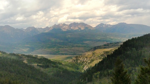
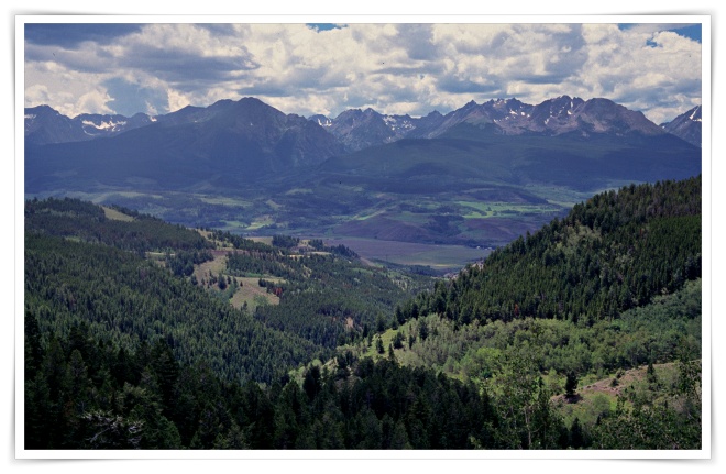
The views of the Gore Range from the lower
approach up the sage hills are the best. Soon the
road crosses a power line, that can't be edited
out of photographs, and then the forest obscures
far views for a long time. Approaching the top
there are a few more prime vantage points on the
Gore Range framed by trees. The top has a fairly
large parking lot and signage detailing trails in
both directions along the Williams Range.
 From East. (described downwards), A fast
decent lined by luxuriant forest leads to a major
industrial site, the Henderson Mill. All of the
numerous sideroad turnoffs are marked with no
trespassing signs. This too shall pass. The
pavement here is very rough, but it is 100 percent
paved, and smoothness soon returns Past the junction with CR32 along Keyser Creek
direction Frazier, CR33 enters a wide valley of
fenced ranching and farm country, contained by
flowing sage hills. There is a large reservoirs on
this side too, sharing the name of the stream and
the mountains just crossed: Williams Fork. There
are unpaved shortcuts available here over towards
Kremmling, involving CR33. But the profile follows
CR3 all the way to its jct with US40 further east. Dayrides with this point as
highest summit:
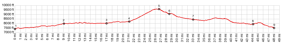
COMPLETELY PAVED ( | Sheep Creek Divide > ) Ute Pass : near jct CR381 Williams Peak Rd - Co9 > Co9 south > CR25 south > Co8 south > Ute Pass Rd east Ute Pass > CR3 north > US40 east > Parshall > Kremmling > Co9 south back to starting point at jct CR381 - Co9: 66.3 miles with 3740ft of climbing in 6:45 hrs (garmin etrex32 m5: 23.08.22) PARTIALLY PAVED / UNPAVED Ute Pass x2: South Boulder Creek trailhead <> Co9 north <> Ute Pass <> Henderson Mine <> end of FR141 <> additional out and back on a forest road : 43,0miles with 5310ft of climbing in 5.19hrs (m3:98.8.9) (pics: dt42_10-11) Notes: this ride was before pavement 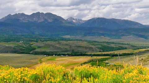 |
 Following
Co9 north presents variable conditions. The
traffic is fairly heavy. But at first there is a
extremely wide shoulder available for biking. It
disappears when the road gets to Green Mtn
Reservoir. The logical thing to do here is follow
the county road around the west side of the lake.
That does make a loop over this pass a little
longer.
Following
Co9 north presents variable conditions. The
traffic is fairly heavy. But at first there is a
extremely wide shoulder available for biking. It
disappears when the road gets to Green Mtn
Reservoir. The logical thing to do here is follow
the county road around the west side of the lake.
That does make a loop over this pass a little
longer.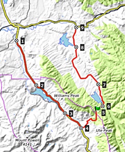 The turnoff to Ute Pass Road is
signed. It seems like the steepest part is right
at the start, climbing the embankment of the Blue
River. Traffic is now history. But I experienced
the most deviative dump truck driving behaviour on
this stretch of the road anyway. But hopefully you
won't.
The turnoff to Ute Pass Road is
signed. It seems like the steepest part is right
at the start, climbing the embankment of the Blue
River. Traffic is now history. But I experienced
the most deviative dump truck driving behaviour on
this stretch of the road anyway. But hopefully you
won't.|
|
advertisement |
|
|
advertisement |