| |
|
|
|
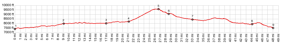
1.START-END WEST: Co9 crosses Elliot Creek, a short distance north of Kremmling
2.northern turnoff to CR30 around west side of Green Mtn Reservoir
3.CR30 rejoins Co9
4.profile turns east onto Ute Pass Rd
5.TOP, Ute Pass, 9600ft
6.road passes first pond of Henderson MIll on East Fork of Ute Creek
7.jct with CR32, heading east towards Winter Park
8.jct with CR33, alternative gravel route to Co9, avoiding US40
9.START-END EAST: Colorado River crossing, immediately before jct US40 - C
|