| |
| |
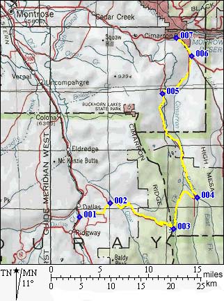
Owl Creek Pass
Owl Creek Pass is a well graded,
long dirt road. Near the top, the road passes
between a rock tower and other fanciful rock
formations, that could be expected in a south
western canyon. But this is alpine Colorado and
lush forest reaches beyond 10000 feet, giving this
pass a unique combination of natural features.
From West. The Owl Creek Pass road can be
picked up from US550, a short distance north of
Ridgway via county road 8 or 10. CR10 is a little
longer but gives better views of the Mount
Sneffels range. The lower half of the approach
leads through private land with virtually every
inch fenced off. The surface on this lower part is
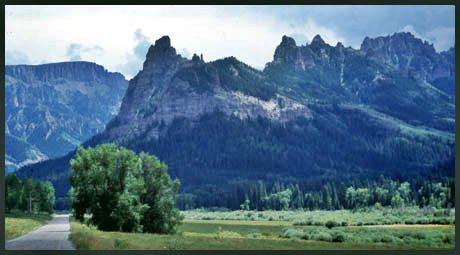
very like a washboard. A signed viewpoint, well up
the pass road, leads to a view of Chimney Rock and
Court House Mtn. The view appears is in perfectly
flat backlight in the morning and as a three
dimensional front lit scene during late afternoon.
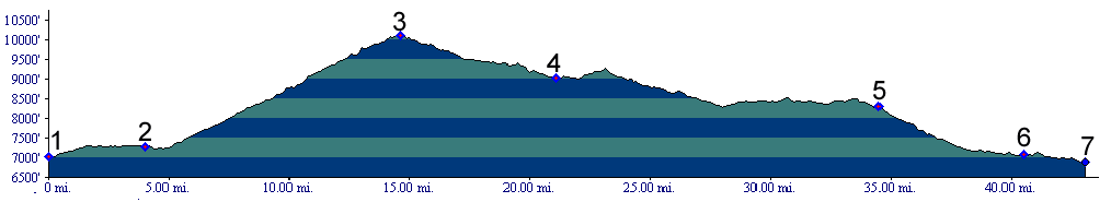
Even though the profile shows this as a completely uniform slope, the upper switchbacks, now heading towards Turret Ridge, become much steeper in the turns. They tunnel through dense forest to the top. The vertical rock formation of the hour, Courthouse Rock appears periodically when the forest opens up. The top is marked with a sign. From North. The advantages of a
counterclockwise loop ride, that is descending
this approach, are as follows. The ride in its
entirety is probably faster because less braking
is needed down the northern side. For the (for me)
long dayride, listed below, this is an advantage.
Also, afternoon storms are more likely to cause
precipitation on the southern approach than on the
northern approach, which is surrounded by lower
scrub dessert hills of the the Gunnison and
Uncompahgre valleys. An advantage of a clockwise
day loop ride ( climbing this side) is that during
the afternoon, the direction of the light makes
for much better views late afternoon on the
western approach, assuming that the weather
produces good sunlight.
Here are a few more notes in a downward
direction. As already mentioned, the road descends
more gently than on the western side. It makes its
way down a straight valley between two layer cake
rock ridges, leaving behind the more imaginative
rock formations. One more scenic highlight happens
above Silver Jack Reservoir, where various forks
of the Cimarron River emerge between abruptly cut
off ridges. The road is more heavily graveled from
the last part of the descent to Silver Jack
Reservoir to Big Cimarron Campground, where the
road also crosses the Cimarron River again. Beyond this point progress is much quicker
because of a hard medalled road in most places.
For this last part, the road is surrounded by
private land and rolls along in a gentle traverse
with a several good far views in both directions.
The turnoff onto P77rd ( below also CR P77 ) to Cerro Summit,
(part of the dayride below ), skips the last steep
downhill to the junction with US50. If turning onto the start of the profile from
west bound US50, a sign on US50 labels the route
as "Cimarron Road", and a second sign mentioning
Owl Creek Pass is encountered a little further up
the road. the CR P77 option goes to the highest
point of Cerro Summit instead. 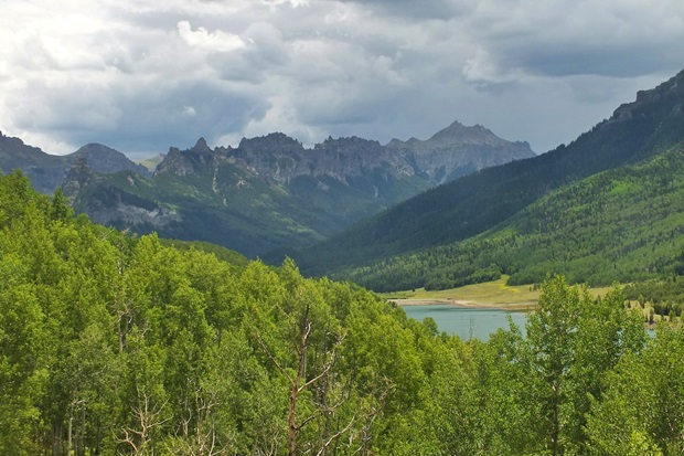 Dayrides with this point as
highest summit: PARTIALLY PAVED / UNPAVED Owl Creek Pass , CR P77 - Cerro
Summit s(u) : Billy Creek SWA > US550
south > CR10 > CR8 > Owl Creek Pass
> P77rd north > CR P77 - Cerro Summit
s(u) > Cerro Summit (shp) > Kinikin Rd >
Paghre Road > US550 south > back to Billy
Creek SWA: 86 miles with 6970ft of climbing in 8.4
hours (VDO MC1.0 m3:5.8.27) COMPLETELY UNPAVED: ( < same page | ) Owl Creek Pass x2: upper trailhead to Stealey Mtn Trail along CR8 <> up CR8 <> Owl Creek Pass <> Silver Jack <> turnaround point on P77rd at intersection with Big Cimarron Rd at 8330ft, just before steep descent to Cerro Summit, point 5 on profile : 47.7miles with 4010ft of climbing in 5:04hrs (garmin etrex30 m5:18.7.22. ( < Dallas
Trail: section West Dallas Creek - Last Dollar
Pass | same page > ) Owl Creek Pass x2: upper
trailhead to Stealey Mtn Trail along CR8 > up
CR8 > Owl Creek Pass <> out and back on
West Fork Rd to its end at the Wetterhorn Basin
Trailhead[1] >> <> out and back dwon
north side of Owl Creek Pass to a turnaround point
about 330ft below summit[2] >> back down CR8
to starting point at Stealey Mtn trailhead:
16.2miles with 1870ft of climbing in 2:12hrs
(garmin etrex30, m5:18.7.21) 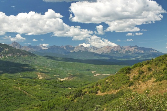 History. Otto Mears Passes (<Cerro Summit|Red Mountain
Pass>}Prior to acquiring its current
name, the pass was called Cimarron Cutoff Trail.
It was one of Otto Mear's many toll roads in the
area and provided access to the Silver Jack area
from Ridgway. 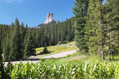 |
 Approaches
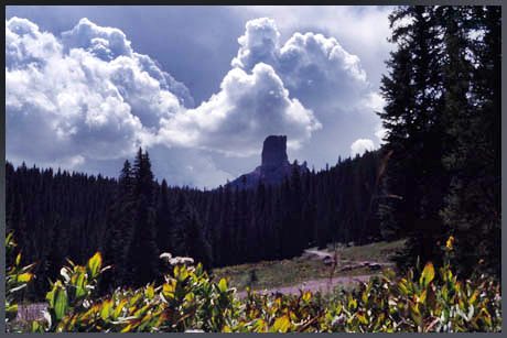
|
|
advertisement |
|
|
advertisement |