| |
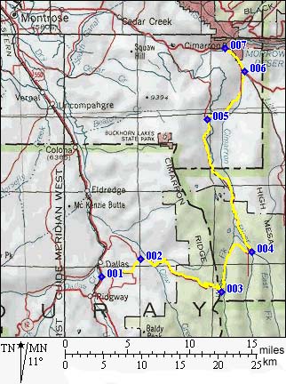
|
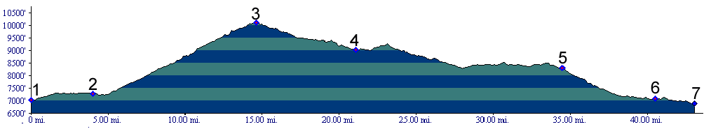
1.(7020ft,mile00) START-END SOUTH: junction of 8rd and US550
2.(7290ft,mile04) take right at T
3.(10114,mile15) TOP: Owl Creek Pass
4.(9020ft,mile22) road crosses Cimarron River. Junctions with roads, going up and down stream are on both sides of the river. Continue downstream on main road.
5.(8300ft,mile35) p77rd leaves towards left. Profile continues downhill along Cimarron road. For connecting profile, see Cerro Summit
6.(7070ft,mile41) START-END NORTH ALTERNATE: junction with US50. Profile continues
west to Cimarron
7.(6880ft,mile43) START-END NORTH: Cimarron. Connecting profiles are Cerro Summit and Blue Mesa Summit.