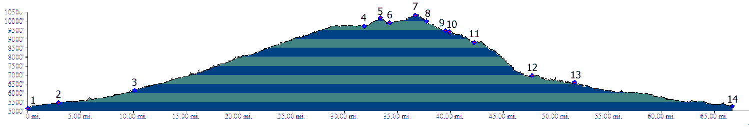
01.(5160ft) START-END EAST ALTERNATE:
Arkansas River crossing on Co67, just north of Florence
02.(5470ft) START-END EAST: start of Phantom Canyon Rd
at jct US50 - Co67.
03.(6130ft) first tunnel
04.(9700ft,mile) jct: Phantom Canyon - Co67. Profile
continues right on Co67
05.(10201ft) Victor Pass
06.(9890ft) profile turns left onto dirt CR82
07.(10313ft) Hoosier Pass
08.(10019ft) jct CR82 - Co67; profile continues left to
Cripple Creek
09.(9460ft) Cripple Creek
10.(9400ft) profile turns off right onto Shelf Road
11.(8800ft) Aregua Gulch joins on left
12.(6990ft) site of Marigold
13.(6600ft) jct with Trail Gulch ( lower end of Shelf
Road).
14.(5280ft) START-END WEST: jct US50 and what becomes
Fields Ave, Canyon City.