| |
| |
Colorado Trail m171.6 s(u)
(section: Elbert Creek Th -
Twin Lakes)
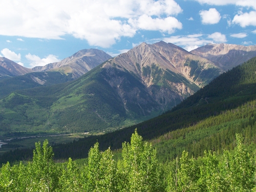
This section of the Colorado
Trail skirts along the flanks of the state's
highest mountain. But that description is
misleading. It skirts very far below the flanks of
this mountain. You don't really see very much of
Mount Elbert. It makes one appearance as a rounded
eminence above a wet meadow, and that's about it.
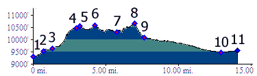
This is still one of the most enjoyable sections
of the trail, mostly because of its cycling
conditions, few rocks, manageable grades, hardly
anything to break your face on, as you skirt along
quickly, hundreds of feet above a wide valley, and
thousands of feet below the peaks.
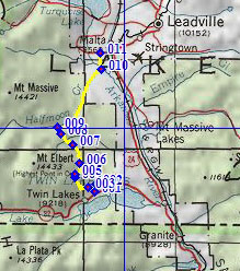
From South. There are several ways to get from Twin Lakes to the upper South Elbert Trailhead on a bicycle. One of them is to pick up the Colorado Trail as it goes under Co72, a short distance west of the Water Diversion Visitor Center. That's the route shown in the profile. There is also a paved road to the north, see the Colorado Trail m175.7 shoulder summit page for other options on this somewhat confusing portion of the trail. Following the Colorado Trail from its Co72
underpass, it is possible to take a wrong right
turn and end up at the paved parking lot of the
lower South Elbert Trailhead. Following the
correct version of the trail, eventually leads to
a dirt road crossing not far below the upper South
Elbert Trailhead.
Dayrides with this point as intermediate
summit: PARTIALLY PAVED / UNPAVED / SINGLE TRACK Mineral Belt
bike trail , Colorado Trail m171.6 s(u),
additional out and back: lower South
Elbert Th > FR125.1B to upper Elbert Th >
Colorado Trail north > Colorado Trail m171.6
s(u) > down Halfmoon Creek Rd > Co300 west
and north > CR5A and CR5 to Leadville >
Mineral Belt bike trail starting on the north side
<> out and back up Evans Gulch > CR38 to
the first mine >> continuing to Mineral Belt
bike trail s(u) > US24 south > CR24 >
Mount Elbert forebay > back to starting point:
52.2miles with 3880ft of climbing in 4:54hours
(VDO MC1.0, m3:11.9.2, t11_6)
|
 Approaches
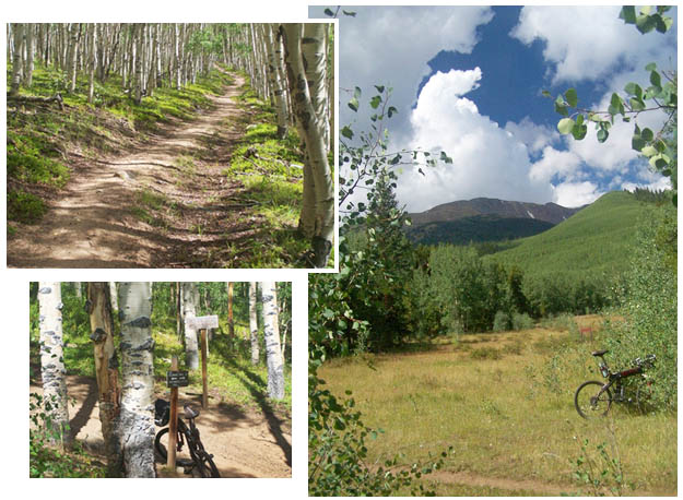
|
|
advertisement |
|
|
advertisement |