| |
|
|
|
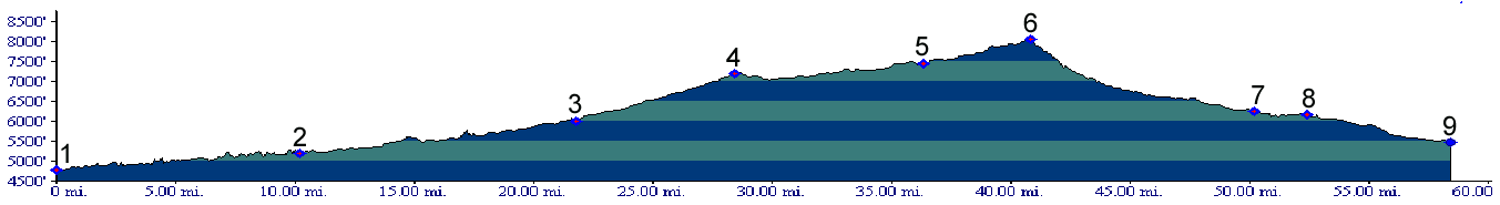
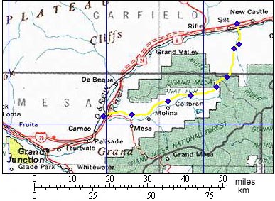
1.(4790ft,mile00) START-END WEST: junction I70, Co65
2.(5200ft,mile11) profile turns left onto Co330
3.(6000ft,mile22) Colbran
4.(7180ft,mile29) road to Colbran Reservoir is on right. Profile continues left
5.(7460ft,mile37) road from Buzzard Divide joins from right. Continue left fork.
6.(8050ft,mile41) TOP: Alkali Creek, Road Gulch divide(u). junction with Mud Hill road on right
7.(6260ft,mile51) profile continues right at this T
8.(6150ft,mile53) profile contineus left at this T
9.(5480ft,mile59) START-END EAST: beginning of Divide Creek Road, south side of Colorado River between Silt and New Castle