| |
| |
For me this is a
quintessential Wyoming Scenery summit, a
dish of high dessert with a side of higher
dessert. The name "Aspen" may be a little
misleading.
This road reaches a summit flanking a ridge with a number of radio facilities, also know as "Three Patches". After riding this I had to ask myself: How can a road to a mountain top above 8000ft in this part of Wyoming look so flat ? But still - the views from this 8000ft point reach further than from most mountains of that height. There is only a small patch of aspen trees visible along the ride, in a shletered location a few hundred feet below the ridge top on the north side. They certainly don't obstruct any far reaching views.
external link to slideshow of pictures on this page +additional
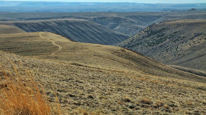
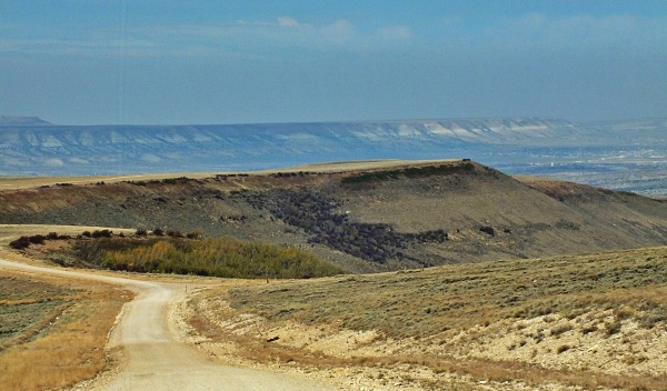
Approaches CR27 skirts along the west
side of the mountain. This is the side with
the best views, a couple of hundred ft below
the antennas.
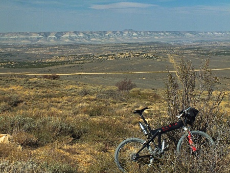
From
North. The way down is fast and
straight, in my case made even faster by a
ferocious wind - almost but not quite from
the back. Still the overall effect was
faster forward movement, with an added
danger of being blown off the road. The
views are similar as from the top: Pilot
Butte to the north, a private gated ranch
the size of a town below, Wilkins Peak
hiding the town Green River, straight cliffs
receding into the valley or the horizon. On
an infinitely clear day, I imagine you can
also see the Wind River Range. One aspect of
a view that becomes clearer and clearer is
this: The mountain on which all those
antennas are assembled is actually quite
long, and the its traversal to the end on
the east side (the side trip below) does
take some time. Patches of previous pavement
finally give way to total pavement at the
town-sized ranch. The profile continues on
Wy430 direction back towards the starting
point, until it reaches a low point 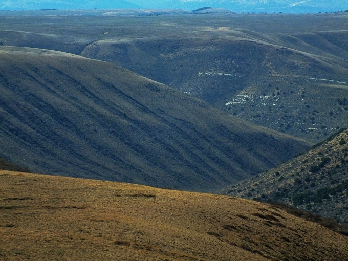
I'm going to write this up as
a one way summit, because that's the way I
did it. But it could easily be a two summit,
replacing this CR27 Aspen Mtn Rd summit. On
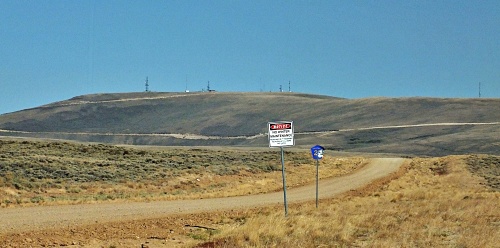
the south side a sign points the way to the
"Three Patches picnic area only". This is
not completely true. Just before reaching
the picnic area, a less traveled double
track trail connects with the top of Radar
Tower Rd. It probably does require a little
walking too. On the north side a more
heavily traveled road goes to the top on the
signed Radar Tower Rd. The turnoff is only
100ft or so below the Aspen Mtn Rd summit.
The top is a long ridge of several antenna
facilities and there are slight dips between
some of them. From the top there are also
other less traveled tracks visible that may
lend themselves to ride to this summit on a
mountain bike. Slideshow
of the Sidetrip to the out and back summit
Dayride with this point
as highest summit:
PARTIALLY PAVED /
UNPAVED
( < White Mtn
Rd via Rock Springs(sh) | CR71
Godiva Rim s(u) > )
CR27 Aspen Mtn Rd(sh): near jct CR30 Baxter Rd - Wy430 > CR30 Baxter Rd west > South Baxter > CR27 Aspen Mtn Rd north <> out and back partially up road to Three Patches picnic area > CR27 Apen Mtn Rd(sh) <> out and back to before last antenna on Radar Tower Rd >> CR27 north > Wy430 south back to starting point: 51.4miles with 3530ft of climbing in 5:08hrs (garmin etrex30 m3:20.9.25)
|
 CR27
Aspen Mtn Rd(sh)
CR27
Aspen Mtn Rd(sh)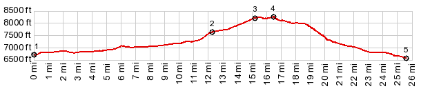

|
|
advertisement |
|
|
advertisement |