| |
| |
Blewett Pass
About the nicest thing to say
about this pass, from a cyclist's view point,
is that it has a great shoulder, good by
western Washington standards, which are very
good already. There are never any rumble
strips. It's still not enough to get away from
heavy truck spray during a downpour though.
But I'm told I should look on the bright side.
So looking on the bright side, compared with
roads in say - Montana - this would be a
road so great, that it borders on the
stellar. That's because Montana is one
of the rumble strip master states of the
American west. Do they justify this, by saying
this is also the state of the sleepiest
drivers ? ... so that they need the rumble
strips to keep them awake ? I don't know. As
for scenery on Blewett Pass - better to look
somewhere else
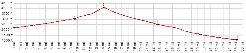
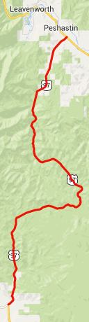
From South. The lower
southern and western approaches meet at a spot
called Verden on the de Lorme Gazetteer. But
there is nothing there - probably not the first
time that a junction is given a name without any
immediately apparent reason. The southern
approach to this point from Ellensberg has
already a small summit point. US97 is quite a bit busier and
leads to the top of the the pass with a
uniformly sloped, elaborately engineered
roadbed, with scenery, that shouldn't distract
anybody from thinking about anything else, than
what they were thinking about anyway ( like for
example how this compares to road conditions in
Montana). There is not the slightest hint of an
interesting view from the top. Two dirt roads
meet on US97 at the summit, and there is a
Blewett Pass sign with elevation. The de Lorme
Gazetteer labels this spot with the offical name
Swauk Pass, using the name Blewett Pass for an
adjacent older crossing of this road From North. The shoulder
on this side is not as wide as on the southern
side. Otherwise - the same conditions as the
north side. Dayride COMPLETELY PAVED: ( < White Pass |
FR9718 -
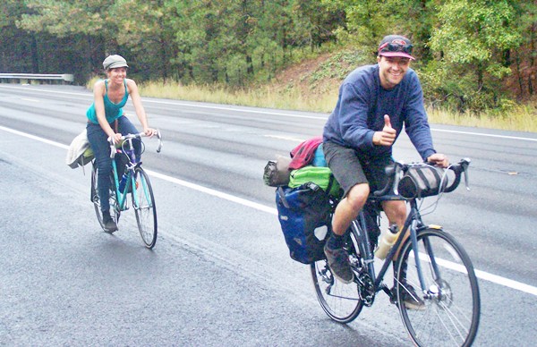
9712(sh) > ) Lucia was from Spain and riding
a Peugot bicycle, just like one I always
wanted, at a time when the US was a one
bicycle country - Schwinn was all that was
available where I lived a long time ago.
Unfortunately the Peugeot was having spoke
problems, in addition to the pouring rain
problem. I wish them all the best.
 -
|
 Approaches
|
|
advertisement |
|
|
advertisement |