| |
| |
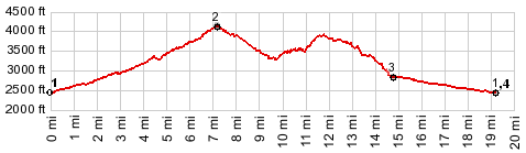
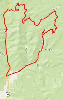
FR9718 - 9712: Wenatchee
Mountains
This is one of many small
shoulder summit points on forest roads between
US97 and Mission Ridge in the Wenatchee
Mountains. It just just happens to be the
highest point during my ride over Old
Blewett Pass.
From South. FR9712 from
US97 is paved as far as Liberty. From there a
good lightly graveled road leads to this
shoulder summit at the junction with FR9712.
Just before reaching the summit the road passes
a far view of Mount Rainier. From the junction
there is also good view of Manatash Ridge. From West. A roll through
the forest goes back to US97. Rather than
following FR9712 back to Liberty, a right onto
9705 makes a larger loop over US97 Dayride PARTIALLY PAVED / UNPAVED ( < Blewett Pass
| FR9712
Table Mountain s(u) > ) -
|
 Approaches
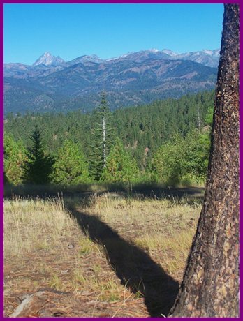
|
|
advertisement |
|
|
advertisement |