| |
| |
Barlow Pass
Both Washington and Oregon have a
Barlow Pass, and each one has its peculiarities.
When I first saw this Barlow Pass on the map, I
thought, that after weeks of searching, I finally
found a nice day loop ride over an interesting
summit - and I did - it makes for an interesting
century loop. But these are the peculiarities: a
substantial part of the southern approach is
unpaved. It stays in the forest the entire time
and you never really see any mountains, except for
a few views framed by trees along the road. Signs in the area refer to this as
Mountain Loop Highway, even if part of it has a
gravel surface.
By most accounts something resembling a mild
climb starts in Darrington, where the "Alpine Loop
Highway" begins. These first 7 miles are the best
part of the ride. Past that the pavement
disappears and is replaced not by broken pavement,
as is often the case in this state, but by gravel
with intermittent washboard. It seems like the
climb should start any minute now. Then the road
crosses the Sauk River and now it must really
start, if ever. But it is really over before it
ever starts. On top of the pass the forest is just
as mysteriously deep and seemingly impenetrable as
further down. On summer weekends the many
trailheads are overcrowded with parked cars. 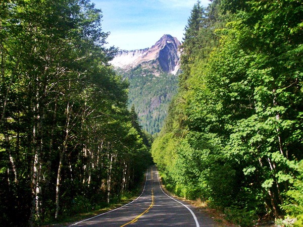 From North. (described
downwards). At the summit the road changes from a
curvy dirt road to a highway with all major curves
removed. It makes this transition without any
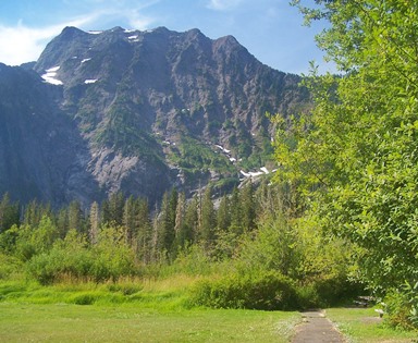
intermediate stages. A nice view of vertical
mountain walls from the meadow below can be
enjoyed at the Big Four Mountain picnic area.
Otherwise map makers have filled in the nameless
space with names, that refer to various solitary
houses in the nearby forest They have used names
like Silverton, Verlot and Robe. Actually the last
destination, Robe, must have more than a couple of
huts hidden in the woods, because at this point
the ride has far too much traffic to be
comfortable and there is no shoulder. But in my
case most drivers except one were very
considerate. The profile ends in Granite Falls, wich even has
a bike store of sorts, actually two bike stores.
Both deal with motorcycles and one also deals with
bicycles.
PARTIALLY PAVED / UNPAVED ( < Canyon
Ridge Trail s(u) | Rat Trap Pass
> ) Barlow Pass : half a mile up FR22 from jct
FR22-Mountain Loop Highway > down FR22 >
Mountain Loop Highway south > Barlow Pass >
Granite Falls > Jordan Rd north > Arlington
Heights Rd west > 115th Ave north >
Arlington-Darrington Rd west > Oso >
Darrington > Mountain Loop HIghway south >
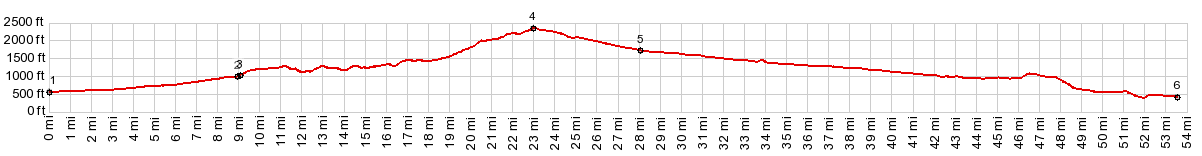
back to starting point on FR22: 97.2miles with
4560ft of climbing in 6:57hrs (garmin etrex30:
r4:17.8.20)
|
 Dayride with this
point as highest summit:
Dayride with this
point as highest summit:|
|
advertisement |
|
|
advertisement |