| |
| |
Soapstone Pass
Soapstone Pass leads
across rounded Uinta foothills to connect the
western approaches of two paved passes, Bald Mountain
Pass and Wolf
Creek Pass. The entire road is a gravel
surface that takes some effort to ride. It is
named on National Forest maps.
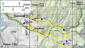
From North. The turnoff from Ut150 is
signed as Soapstone Basin. After passing a number
of camping facilities the road traverses steeply
through dense forest to the east. As it emerges
into a a clearing, the summit section can be made
out above as an expansive meadow. The meadow is
followed by a grassy ridge, rounded as a
cresting clay roof shingle. Down South. It's a quick descent through
trees with a few switch backs near the end, before
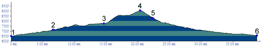
joining the Wolf Creek Pass road. Tours Dayrides (paved+unpaved) : A 9 shaped
ride starting near Kamas, going to the top of Bald
Mountain Pass, then turning around and taking
Soapstone Pass to Wolf Creek Road, returning to
the starting point via Francis and Kamas measured
64 miles with 5800ft of climbing in 6:1 hours
(m3:07.06.10). |
 Approaches
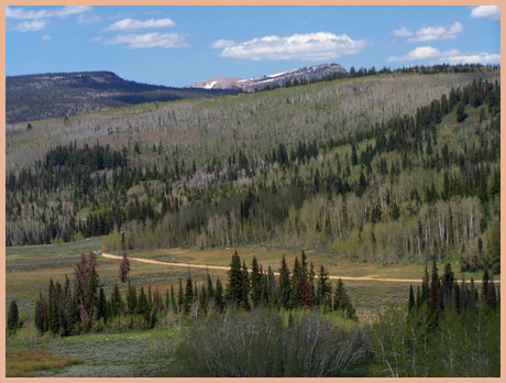
|
|
advertisement |
|
|
advertisement |