| |
|
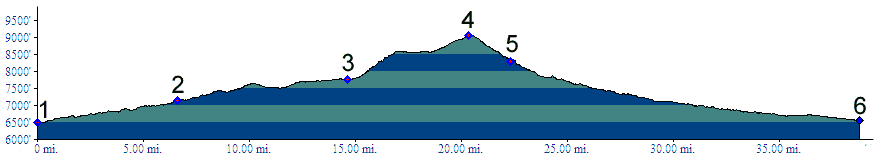
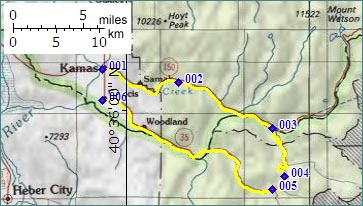
1.(6490ft,mile00) START-END NORTH: Kamas, jct: Ut150 - Ut32
2.(7160ft,mile07) Yellow Pine campground
3.(7170ft,mile15) profile turns right onto dirt road into Soapstone Basin
4.(9077ft,mile21) TOP: junction with forest road on left
5.(8300ft,mile23) junction with Wolf Creek Pass paved road. Profile continues downhill to right
6.(6560ft,mile39) START-END SOUTH: Francis, jct Ut35 - Ut32