| |
|
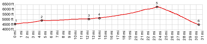
1.START-END EAST ALT:jct US6 - road signed
to Amasa Basin ATV trail
2.profile turns right onto 3cRd (not signed)
3.route merges onto Death Canyon Rd (not signed)
4.START-END EAST: left turn onto old Hiway 6 and 50
5.TOP: Marjum Pass, 6260ft
6.START-END WEST:jct with Tule Valley Rd
|