| |
| |
Hancock Rd s(u)
This is anything but a trophy
summit. But it is an extremely pleasant bike ride
with little traffic, in an area where most other
roads are full of rumble strips and speeding cars,
towing other motor contraptions. It also happens
to be a small summit ride.
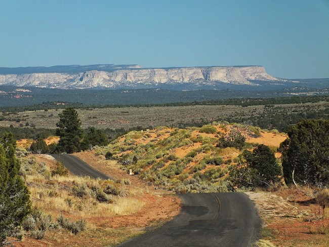
A long shallow climb leads to a wide gap flanked
by hills, partly covered with a deep red sand.
It's hard to tell exactly where the summit is. But
a few views reaching far into Arizona with various
cacti serving as foreground are at the summit.
From South. Colorado
City consists of scattered housing in the dessert,
but you can't buy anything there, while passing
through. As the small road approaches the cliffs
to the south, and makes its way up one of the wide
shallow sage canyons, it crosses into Utah and a
large table top mountains appears. In the top
field of vision red sanddunes flank the hills,
that form a funnel to this shallow pass. This is
part of Pink Coral Sanddunes State Park. To look
around inside they charge 3 dollars. There
are no hiking trails, but at least you are
free to climb the dunes. After Ut43 summits, a
right leads a little higher with a short steep and
straight climb. 
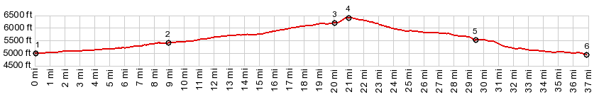
 Dayride with this point as highest summit: COMPLETELY PAVED: ( < Ut9 Zion NP s(u) | Cedar Breaks s(u) > ) Hancock Rd s(u) , Ut43 Coral Pink Sanddunes Rd(sh) , US89 Kanab - Kanab Jct(sh) : ~1.5miles south of jct Ut43 - US89 > Ut43 south > Ut43 Coral Pink Sanddunes Rd(sh) > Arizona State line << turnaround point jct with next main road in Az > Ut43 north > Hancock Rd s(u) > US89 west > US89 Kanab - Kanab Jct(sh) > back to starting point on Ut43: 63.9miles with 2910ft of climbing in 5:16 hrs (garmin etrex30 m3:19.10.8) 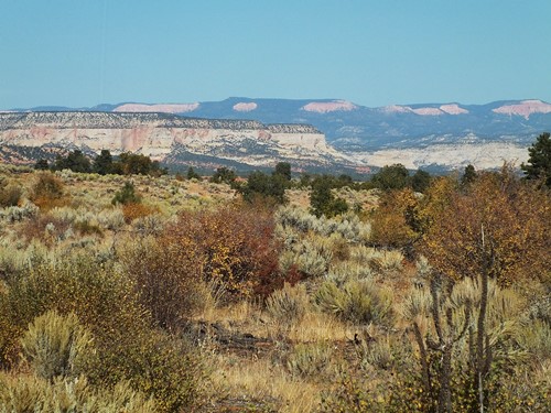 |
|
|
advertisement |
|
|
advertisement |