| |
| |
FR95 Causeway s(u)
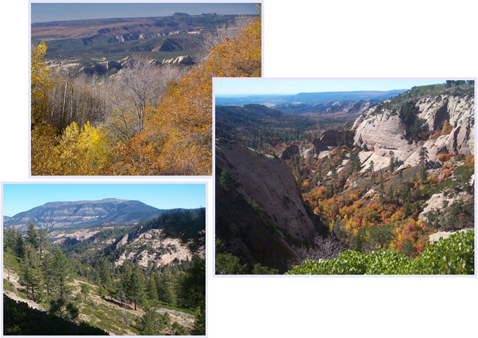
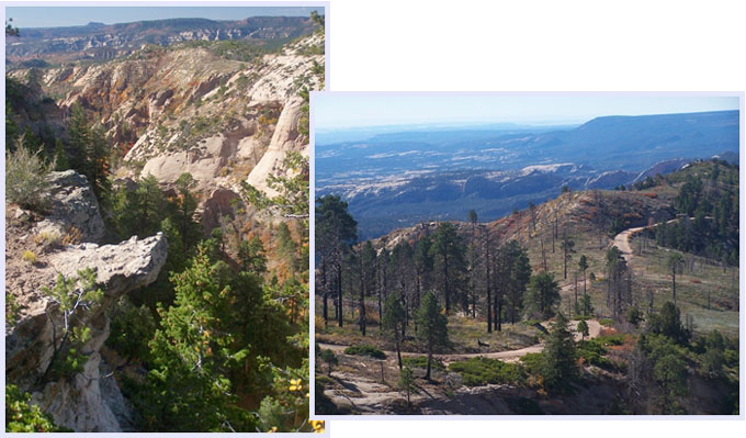
The high traverse below Mount
Linnaeus in the Abajo Mountains gives the
impression of a road, originally planned to
attract tourists - but they never came. I don't
know why they didn't. Maybe they're too busy
hanging out in Moab, or maybe I just hit a lucky
low traffic October weekend. Whatever the reason,
the lack of people on this road just makes it an
even better bike route. If making a loop out of
the high traverse, it's a good idea to be prepared
for a variety of different road surfaces.
From West. Approaching Blanding from the
south, Ut91 starts to gain elevation from where it
crosses Westwater Creek. On a loop ride, Blanding
is an intermediate low point. Ut91 makes a right
angle turn to the right in the center of Blanding.
Making a right angle left turn at the next block,
will lead past a school onto paved Blue Mountain
Road. It leads up a western extension of the Abajo
Mountains at a comfortable grade. When the road
crosses onto National Forest land the surface
becomes a hard dirt or medalled surface. This fast
surface stays till about the summit. The turnoff
onto FR95 is signed, including destinations
Causeway and Gooseberry. Soon the good part
starts. The road contours around Mount Linneaus
with prime view onto the rock outcrops onto
opposing Elk Ridge. The road reaches its highest
elevation before it gets to the Causeway.
From East. (described downwards). This Causeway is a narrow landbridge that connects this plateau of the Abajo Mountains with Little Dry Mesa. From here to the junction with the Cottonwood Creek Road the road contains frequent sandy stretches. They would be hard to ride uphill, but don't force you to get off your bike downhill, well - maybe just once, when you don't pay attention. After the road makes its artful curves over a lumpy ridge at Maverick Point, the road stays a little further from the edge. This is just as well, as far as I was concerned. It was getting late fast, mostly because of all this incredible picture taking, and a lot of the loop was still ahead. Once the Cottonwood Creek Road becomes visible in the valley, descending in the opposing direction, the pace picks up considerably. A number of surfaces are encountered on the way down, almost like a test bed to see what will work, big rocks with gravel, light gravel, fresh sand, hard medalled, and best of all - just left alone. The surface tends to improve the further down you go. Cottonwood Road gives its name meaning with miles and miles of stately Cottonwood groves, protected by a shallow canyon. The road crosses several times in and out of Ute
Reservation territory, and there are numerous
crossings of Cottonwood Creek. The largest one is
the last one, right after crossing out of Ute
territory for the last time (see also the FR88 the
Notch s(u) page). Following this route
upstream, the no "trespassing Ute territory",
combined with the manufactured looking lake in the
road may have an intimidating effect on uproad
travelers. However, this is the only crossing of
this sort. The road soon terminates onto FR92. If
connecting back to Blanding via CR228, the turnoff
is not signed. If you miss it you end up on US95
south west of Blanding.
Dayride with this point as highest summit PARTIALLY PAVED / UNPAVED FR95 Causeway s(u), CR228
Blanding s(u) : Blue Mountain Road
> FR95 Causeway s(u) > down Cottonwood Creek
Road > east on CR228 > CR228 Blanding s(u)
> Blanding > up Blue Mountain Road > back
to starting point: 68.1miles with 6160ft of
climbing in 6:17hours (VDO MC1.0 m3:11.10.17).
|
|
|
advertisement |
|
|
advertisement |


