| |
| |
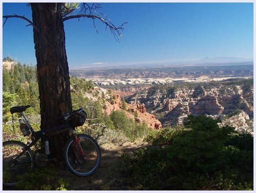
FR88 the Notch
The road following Elk Ridge from
Natural Bridges National Monument towards the
southern part of Canyonlands NP has been used
occasionally for a supported bike tour, lasting
two or three days. But It is also possible to
split up this route into adjoining loop rides,
adding some additonal roads. This is one of those
loops. It follows the traditional Elk Ridge route
between points 3 and 11, which includes its
highest summit point. The advantage over doing
just the ridge is, that you get to see even more
of the Abajo Mountains and the multilayered
pedestal it sits on from a very different eco
zone. The riding surface on the rest of the
described loop is not quite as comfy perfect as on
the ridge route.
From South-East. The junction of CR228 South Elk Rd and CR268 Cottonwood (Creek) Rd is signed. A few miles up this junction on Cottonwood Rd, the road enters the Ute Indian Reservation, complete with bearpaw marked signs and the list of things that are prohibited. One of these items is bicycling. The sign does not refer to this public access road. Bicycling is still legal, even in this part of Utah. The sign combined with what looks like a man made lake in the road may make this approach look somewhat intimidating at first look. In October this ford was easily crossable, but you do get wet feet. The road continues, switching in and out of the reservation as well as a great parade of Cottonwood trees, which however look very sick. The creek fords continue but they do get much
smaller, until you can't decide weather to still
count them as a stream crossing or a crack in the
road, when you realize that you've lost count
anyway. Suffice it to say there are quite a few.
As the grade of the road picks up, closer to the
junction with FR95, the surface switches
intermittently to gravel or hard medalled. The top
was being worked on, so I don't know what the
final result will be. When the route turns left
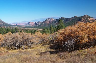
onto FR95, the view shed opens up onto red cliffed
mountains to the north. The climbing is now at a
more steady rate than earlier, on a fast, hard
medalled surface. FR95 ends onto FR88. From here
on many junctions lead to points on the rim and
the point of decision comes closer, which ones to
ride, which ones to skip, which ones to assign a
project number to. The road crests at a point that
is hardly noticeable even with an altimeter. It is
located shortly before the turnoff to a spur
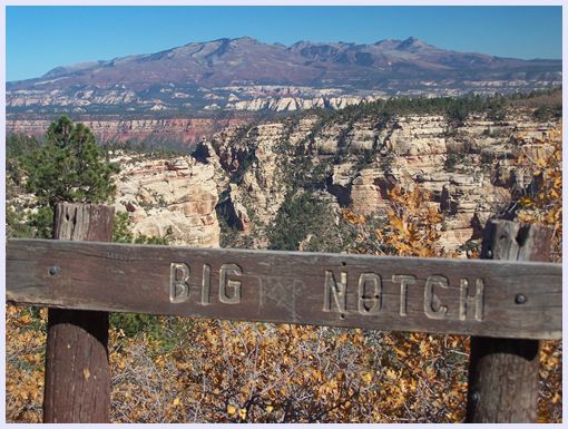
overlooking the Chimney Park area. The spur is
only marked with a FR170 sign (meaning FR5170).
From South-West. (described downwards).
Next on the menu is the main course in the scenic
department. The main course in the climbing
department is already digested. A few switchbacks
lead down to a land bridge dividing Dark Canyon in
the west, from Notch canyon to the east. A climb
leads back up to the mesa, still carrying the name
Elk Ridge. Finally a long fast descend leads to
the junction with CR228 South Elk Road. The fast
descend on perfect surface continues east on South
Elk Road. Approximately where the road emerges
from dense tree cover onto a rocky dessert scape,
still high above the darker valley rocks, the
surface turns into a fairly deep gravel. Still,
going downhill is no problem. The road levels out
for a short time where it crosses over Navajo
sandstone, then dives deeper. It crosses
Cottonwood Creek just before you get back to the
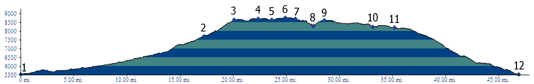
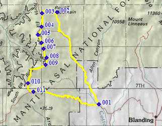
starting point of the profile. Dayride with this point as highest summit: FR88 the Notch s(u) , additional out and backs
: 2 miles east of jct CR228 - CR268 > up CR268
Cottonwood Creek Rd > west on FR95 > south
on FR88 <> out and back to Deadman Point
>> south on FR88 <> out and back to
Chimney Park area >> FR88 the Notch s(u)
<> out and back to Steamboat Point >>
south on FR88 > west on CR228 West Elk Rd >
back to starting point: 70.7miles with 5550ft of
climbing in 6:29hours (VDO MC1.0 m3:11.10.19) 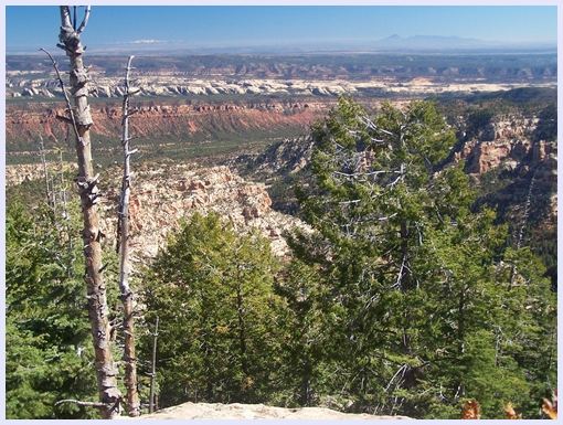 |
 Approaches
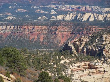
|
|
advertisement |
|
|
advertisement |