| |
|
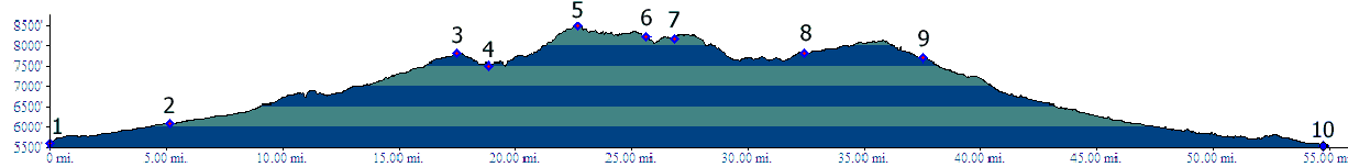
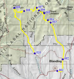
01.(5570ft,mile00) START-END WEST ALT.: Ut91 crosses Westwater Creek, southwest of Blanding
02.(6090ft,mile06) START-END WEST: Blanding, Ut91 makes a right hand turn. Profile turns left 1 block after this
03.(7820ft,mile18) Profile turns left, from Blue Mountain Road, onto FR95
04.(7490ft,mile20) intermediate low point
05.(8490ft,mile23) TOP
06.(8230ft,mile26) Skyline Trailhead is on right
07.(8190ft,mile27) the Causeway, road crosses to Little Dry Mesa
08.(7800ft,mile33) Chippean Rocks. Profile stays right at this fork. Left fork converges back to this route after a few miles.
09.(7700ft,mile38) Profile turns left, down Cottonwood Creek Road
10.(5540ft,mile55) START-END EAST: Cottonwood Creek Road terminates onto FR92 Elk Mountain Road.