| |
| |
FR111 Joseph Peak(sh)
There are many ways to construct
loop rides with great climbs in the southern part
of the Pavant Range. The southern end not reach
quite as high as the northern part of the same
range or the Tushar Moutains to the south. But
there are many more ride options here. This is
just one possibility. It connects Richfield, the
major center of commerce in the Sevier Valley with
the miniscule town of Joseph. The northern
approach is not the most direct approach to the
summit point. That would connect Elsinore to
Joseph.
From North. From the watertower in
Richfield a steep dirt road leads up into the
Pavant Range. It's difficult to see the road from
the valley. But it's easy to find by heading west
from the junction of US89 - Ut119 in Richfield.
The road rolls along often with very steep
sections, that made me get off and push a while.
But the improvement in the vista of the Sevier
Valley makes it worth the effort. Going right at the first junction leads to the FR96 White
Pine shoulder summit, amongst many other
possible summit points. This tour heads south
instead, signed as the Elsinore Road. The road
stays quite a distance to the east of the crest of
the Pavant Range - nice views of the Tushar
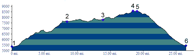
mountains to the south. The highest point between the Deer Creek Canyon
ascent from Richfield and the the Elsinore road
coming up from the town of the same name is not
marked on the profile above. But it reaches
7900ft. This would be the most direct appraoch to
this summit from the north. The road winds along the top through pleasant
juniper forest, a new view never far away. The
road also passes through a stretch of private land
approaching the summit. 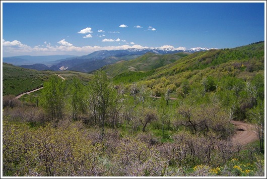 From South (described downwards). There
is no view from the summit. Shortly past the
highest point the road merges onto FR110. Going
right here would lead over a higher point closer
to Joseph Peak. Peak is somewhat of a misnomer for
this gentle forested hill in the Pavant Range. But
the word peak seems to be used indiscriminately
for other bread loaves in this area also. The profile goes left and winds down in a few
steep switchbacks with an impressive view of Clear
Creek Canyon, separating the Pavant Range from the
Tushar Mountains. This road has a fairly deep
gravel surface, that would make it difficult to
climb on. In the end it makes a straight run down
through dessert sagebrush country to Joseph. If
heading back north to the starting point, there is
even a bike path along US89 between Joseph and
Elsinore.
Dayride PARTIALLY PAVED / UNPAVED ( <FR096
White Pine (sh) | FR113
Winkler Point s(u)> ) 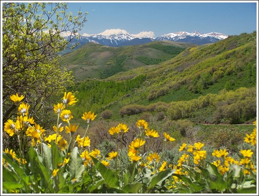
back to cycling Utah's summits and passes |
 Approaches
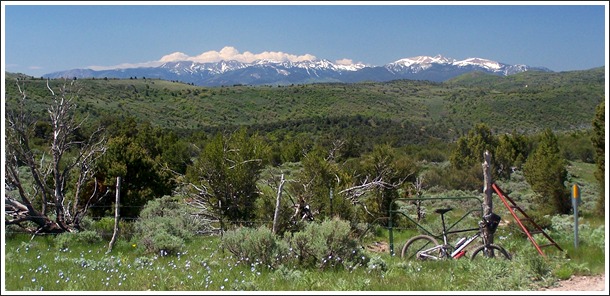
|
|
advertisement |
|
|
advertisement |