| |
| |
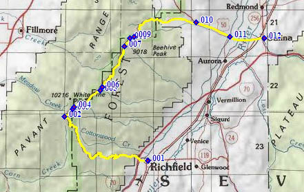
FR096 White Pine(sh)
Sevier County is very popular
with ATV riders, because of the Paiute and other
trail systems. To illustrate this point the
tourist brochure, put out by the local chamber of
commerce, has this quote between two pictures of
ATV riders, roaming through the woods: "When I die
- bury me on the Paitue Trail, so when my husband
hits a bump, he'll think of me". - Oh well, nobody
every accused ATVers of being "sensitive new age
guys".
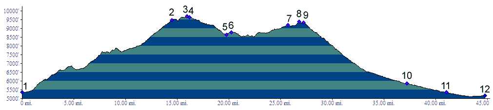
Luckily bicycles are also still allowed on these roads and trails. This particular summit is on the Paiute trail. But here it is really just a regular dirt road, and during my traversal of the route during a Monday in June, I only saw two other travelers along the route, not counting the first two miles near Richfield, which is very busy. The route climbs the Pavant Range and then follows it, some distance to the east of the ridge line.
From South. I didn't see any signs in
Richfield for the start of this dirt road climb.
The road cut is also not visible from town. But it
is still easy to find. At the jct of US89 and
Ut119, the major intersection in town, one turns
west and then crosses below I70. The road seems to
end at the water tower, but once there, it becomes
apparent that it continues - forever you might
say. A steep climb through juniper dessert and rocks
leads to a first high point. After the road drops
down into a a low ravine, the view of the steep
western dropoff on Mount Terrill (11548ft), on the
other side of the Sevier Valley, disappears. At
the first intersection, which is elaborately
signed, the profile stays right, and is now on the
Paiute Trail, here a regular dirt road, slowly
winding upwards through low ravines. 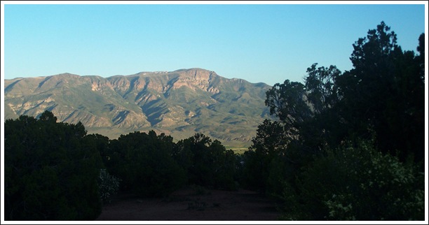 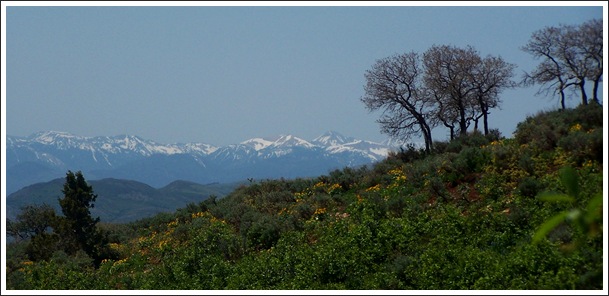 top: Mount Terrill from lower part of FR096 bottom: Tushar Mountains in the distance The Tushar Mountains to the south appear as
snowcapped background to isolated stands of
Juniper trees, as the road winds above treeline on
a breadloaf shaped mountain. The road climbs the
ridge line, and also comes to the next
intersection, again elaborately signed. To the
left are dead end roads to Sunset Peak, Devil's
Armchair and other attractions. On the other side
of the ridge is also White Pine Peak, another oval
breadloaf, with an antenna on top. Staying right
at this intersection, the road quickly reaches its
highest point in the forest. From North (described downwards). There
is no view here, but just a few feet lower the
road emerges from the forest and presents Sevier
Valley in all its hazy beauty. To the left a road
climbs over a shoulder of White Pine Mtn and
descends into Fillmore, reaching a slightly higher
elevation. During my traversal, there was still
enough snow on it, to force one truck driver to
turn around. It looks like from here on it's downhill,
traversing downwards along a straight ridge. But
actually this is not true. There is much riding
and also climbing still ahead. Signs along the
roadside allow measuring progress on the map: Hans
Ridge, Chokecherry Canyon, Trough Canyon, Bean
Canyon, Paradise, and many more named landmarks,
without any signs of humans. If you would try to
find them all on the map, you would never have
time to complete the ride. As the road winds around a red ridge cropping out
of the forest, it becomes clear that another
summit is ahead. The route seems to wind around
Beehive Peak, as if contouring along the seats of
an amphitheater. For all I know this peak could be
the prototype for the beehive in the "beehive
state" road sign. It looks exactly like it. The
second summit comes just before the jct with a
dead end road to Coffee Peak. From here a fast descent, traversing along a
forested ridge, aims for US50. It also goes
through a section of dense pine forest, rich with
shade, the only ecozone of this type along the
route. Rather than continuing to follow the Paiute
Trail, the profile aims for US50 and goes all the
way downhill to Salina. 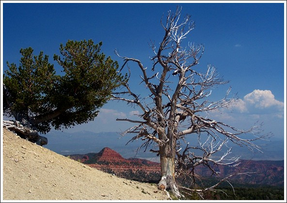 two different frames around Beehive Peak
Dayride PARTIALLY PAVED / UNPAVED ( <FR150
- 290 Mary's Nipple | FR111
Joseph Peak(sh)> ) back to cycling Utah's summits and passes |
 Approaches
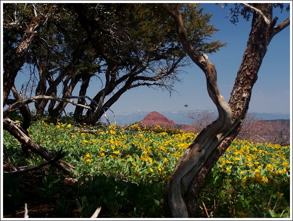
|
|
advertisement |
|
|
advertisement |