| |
|
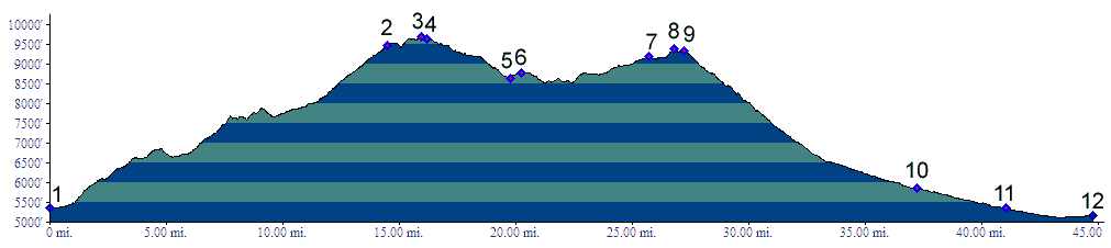
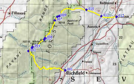
01.(5350ft,mile00) START-END SOUTH: Richfield, jct US89 - Ut119
02.(9470ft,mile15) profile stays right on FR096
03.(9690ft,mile16) TOP: highest point on road, just east of White Pine Mtn
04.(9640ft,mile17) road on left goes to Fillmore, profile stays right
05.(8650ft,mile20) intermediate low point
06.(8780ft,mile20) intermediate high point
07.(9180ft,mile26) improved road on left goes to Fillmore
08.(9390ft,mile27) FR102 (sh) Pavant Range
09.(9330ft,mile28) road on left dead ends at Coffee Peak; profile stays right down Willow Creek Canyon
10.(5860ft,mile38) jct with US50; profile turns right
11.(5350ft,mile41) START-END NORTH ALT: jct with Ut256 to Aurora; profile stays on US50
12.(5160ft,mile45) START-END NORTH: jct US50 - US89, just north of Salina