| |
| |
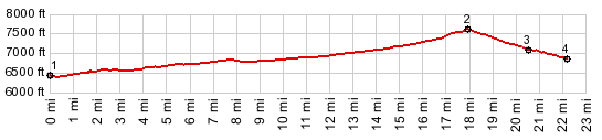
Robinson Pass
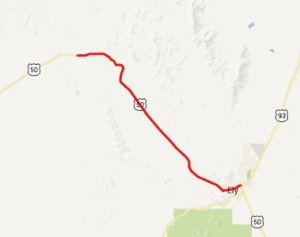
West of Ely, US50 crosses several
pancake like passes and summits. Even though they
are not much lower than Sacramento
Pass and Connors
Pass to the west of Ely, the scenery on the
east side feels much more like an undulating plane
than a mountain pass crossing. Drivers probably
never even know that they are crossing several
passes and summits. But cyclists certainly do, and
all of these summits are nice vantage points on
the surrounding scenery.
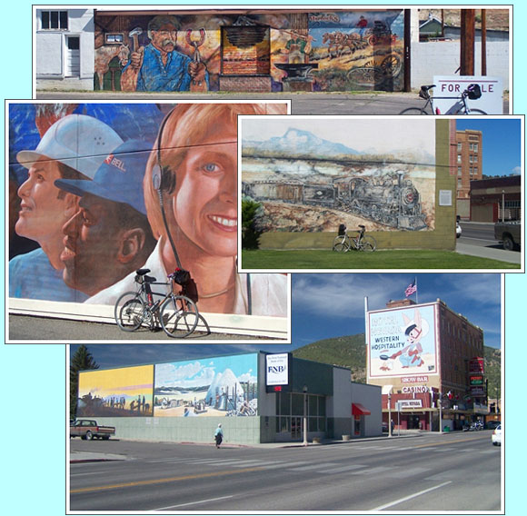
From North. Leaving Ely through its
western end, you ride through a veritable mural
art gallery. This old main street shows the town
from its most attractive side. After that the
first 5 miles of US50 climb ever so slightly and
parallel the rails, that belong today to the Ely
Railroad Museum. In Ruth the road is dwarfed by
the surrounding hills, which in this case are
tailings from the adjacent mining operation. A long line of a road heads into the pancake like
hills to the northwest. During the last mile or
two a noticeable climb crests in a curve. During
clear, late light the view onto the part of the
Egan Range, that is south of Ely has a grandiose
dessert quality, that I tried to capture in the
picture below 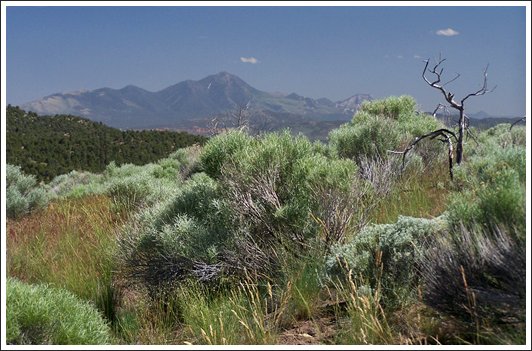 telephoto view of Egan Range from summit of Robinson Pass From South. (also described upwards) US50
crosses the sage flat of Jakey valley in a single
straight line. But I probably shouldn't even be
mentioning that any more, since that is what US50
usually does in Nevada valleys. But to me it is
still a spectacle. Trying to figure out just the lowest spot in this valley really, is one way to keep the mind occupied, and in vast surroundings like this, it's an interesting question. On a bike it's virtually impossible to tell where the lowest spot along the road really is. Looking at the surroundings float by ever so slowly, a slight upward bend now makes the road now seem flat. But the maps says the bike is going uphill already. And usually there is a strong wind, that distorts the perception even further. Finally - there is no stream, not even a dry stream bed that I could see, that marks the spot. As for the rest of the ride: the road climbs ever so slightly and stays in a ravine almost to the top.
Dayride with this point as highest summit COMPLETELY PAVED: ( < Osceola
Road s(u) | Little
Antelope Summit > ) |
 Approaches
|
|
advertisement |
|
|
advertisement |