| |
| |
Carroll Summit
When you want to get away from
traffic, it is often pretty easy to find a dirt
road to do this. But to find a paved road over a
picturesque, named summit with virtually no cars
at all, that is much more difficult. I found one.
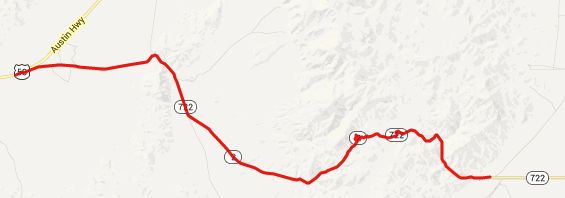
NM722 parallels US50 (roughly speaking), east of
Austin. Signs warn of minimal maintenance, which
further keeps away cars. I had no problems with
the maintenance, and a great time with the
scenery. The major attraction is the feeling of
isolation in this area.
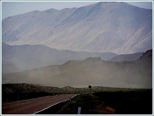
 Approaches From West. Nv722 reaches a low point at
Eastgate, a place prominently labeled on the map.
But don't expect to find a place to refill water
bottles. Instead an attractive, old abandoned
looking house stands at the entrance of a dry
canyon, and a historical marker talks about
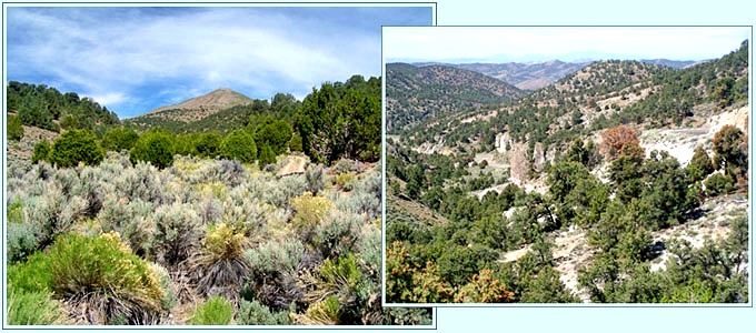
camping spots and watering holes. 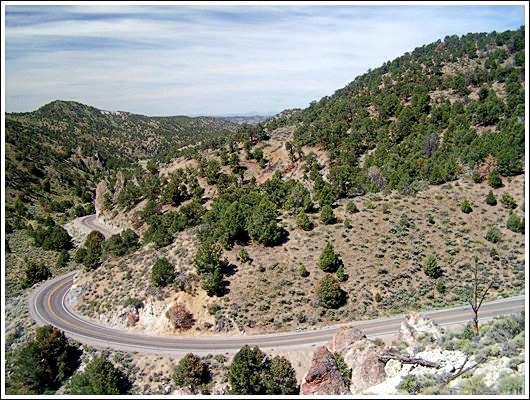 the last curves before reaching the summit On the other side of the gate , the scenery is
not much different. The canyon soon spreads out
into a valley, and trees are still something to be
seen closer to the horizon. But the steadily
climbing road eventually does make its way into a
low canyon in the southern end of the Desatoya
Mountains, with evergreen trees, parched soil and
flowing green hills. Approaching the top are a few
very picturesque switchbacks, where the dessert
now plays a background role, and a green
triangular pyramid shaped mountain shows the way
down the other side. From East: (described downwards) Sagebrush hills give way to a view onto a Salt Sea when the road enters Smith Creek Valley. Before rejoining today's US50 the road still has to cross another "pass", a barely noticable slope over a straight road called Railroad Pass. History Modern Highways: Carroll
Pass was the old historic US50 for some time. The
route of US50, the Lincoln Highway, changed
several times. First it followed a route that was
selected for horse travel, the Old Overland Route
over Basque
Summit, through a much more verdant scenery
than this route. Later US50 followed closer to
today's route over New Pass. In 1924/25 US50 was
rerouted over Carroll Pass, in an effort to
shorten the route by 15 miles. Beginning in the
1930s efforts were made to change the route back
to the original Railroad Pass, a longer, less
scenic option, but with lower and straighter
approaches. 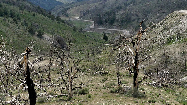 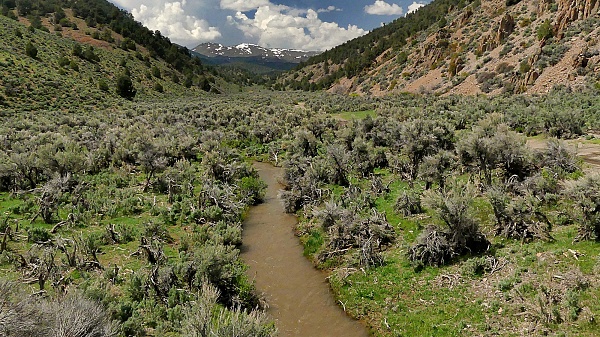
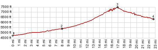
Dayride with this point as
highest summit: PARTIALLY PAVED / UNPAVED ( < Earthquake
Faults Rd s(u) | Austin Summit
> ) Carroll Summit , Buffalo
Summit : Nv722 ~6miles below summit
> Nv722 west > up unmarked gravel road
following Buffalo Creek > Buffalo Summit >
unmarked road heading NE > jct with Nv722
<> short out and back to Peterson
Station[site] >> Nv722 west > Carroll
Summit > back to starting point on Nv722:
51,7miles with 2850ft of climbing in 5:19hrs
(garmin etrex32x m5:23.5.20) A dayride with this point as
intermediate summit is on page: Basque
Summit
|
|
|
advertisement |
|
|
advertisement |