| |
| |
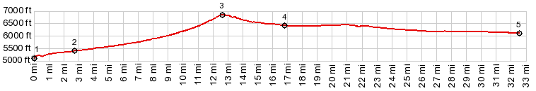
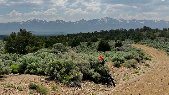
Buffalo Summit This is a low summit on the
northern end of the Desatoya Mountains. The
surface keeps cars away in equal measure that it
should attract cyclists. But this area is so
devoid of people, that this last observation is
purely hypothetical. Let me rephrase this: If
there were people ... this gravel summit should
attract the cyclists among them, assuming there
are some ... of which there is no evidence. In
short, no bikers no people, just gravel and you.
Who needs people ? The scenery is as expansive
as one could imagine. It makes a good,
comfortable day loop together with paved Carroll Summit.
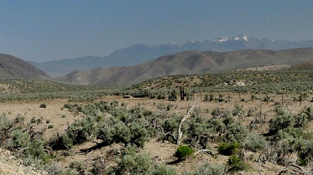
The initially straight road exhibits
some bends after a while, as it climbs into a
loose juniper forest on the north end of the
Desatoya Mountains. Over the top the surface is a
little more mountain bike worthy - just a very
short section From North. (described
downwards) As the road summits over the gentle
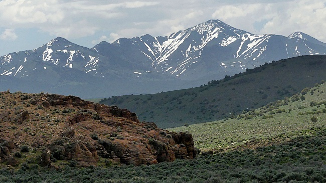
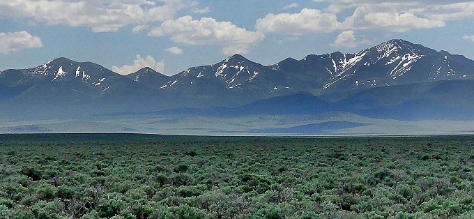
top, the Shoshone Mountains come into view on the
other side, floating in a sea of sage and haze.
What looks like a straight line on the map is
actually a road with plenty of slight direction
corrections. It makes the whole experience of
riding in this monumentally wide and expansive
valley (I would call it a plain) a little less
ethereal, which is still plenty ethereal enough.
If this is a day loop, you have to
take a hard left here, if there is any hope of
reaching back to the starting point. This is also
what the profile does. This road has the character
of an endless ray running along a plain. The
profile follows this gravel highway all the way to
its jct with Nv722, which also happens to also be
the low point for the start of the profile up
Carroll Summit. The surface is generally very bike
friendly, with exception of the last several miles
before meeting Nv722 pavement, which has a few
quite sandy stretches.
|
 Eventually
the road meets a large intersection with several
possibilities, but without aid in the form of
signs, to help you choose between them. At this
intersection I saw the only other vehicle on the
unpaved portion of the ride, on this
otherwise busy Saturday. It sped by at 60 miles an
an hour in a cloud of dust.
Eventually
the road meets a large intersection with several
possibilities, but without aid in the form of
signs, to help you choose between them. At this
intersection I saw the only other vehicle on the
unpaved portion of the ride, on this
otherwise busy Saturday. It sped by at 60 miles an
an hour in a cloud of dust. 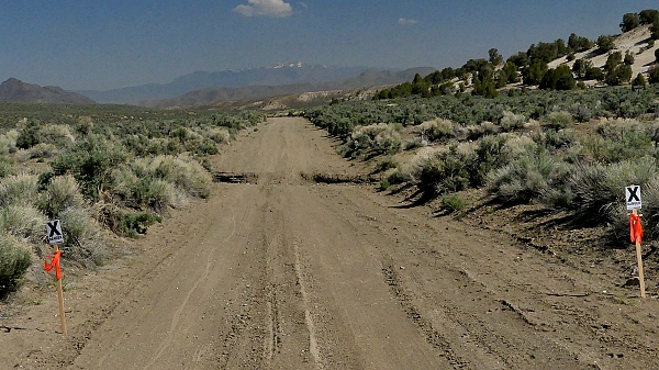
|
|
advertisement |
|
|
advertisement |