| |
| |
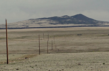
Laughlin Peak / Blosser Gap Rd s(u) I think the eastern plains
of New Mexico can be a scenically
fascinating place. They are dotted with
small canyons and miniature peaks and
mesas of every conceivable shape. The area
gives the impression of being all
privately owned, with a forest of no
trespassing signs. There are small plots
of public land interspersed, but they are
not signed, often without public access,
and I got the impression that this was not
an accident. In this way, this area seems
like an extension of close-by West Texas. From the profile it looks
like this route is pushing the limit of
still being called a summit - it is so
flat. But the changing views made it
definitely feel like one.
This turns out to be a good
gravel road, that climbs ever so slightly.
This rolling plain is doted with small
volcanic features that stick out of the
landscape like breadcrumbs on a wrinkled
table cloth.
The road passes one private
home. The owner came speeding after me in
his golf (or hunting) cart to check what the
stranger was doing on the public road near
his property. According to him at the next
junction, the logical bike route stays left.
The right, going direction Capulin becomes
extremely rough after some miles. That had
been my original intention, but I followed
his advice. This new road is signed as
Blosser Gap and makes a shallow but
scenically fascinating summit behind - not
Laughlin Peak (which I cannot find on the
map), but something called Tinaja Mountain
(7756ft).
From
North. (described downwards). On the
ever so shallow way down, the road crosses
between countless private land boundary and
ranch - no trespassing signs. It follows a
shallow ravine, that seems perfect for
keeping a herd of cows in place all the way
to the I25-US64 exit for Taos - bound
traffic. The profile continues on the
rumble stripped yet super spacious shoulder
of this road for a a few miles and then
takes a barely used straight-as-an arrow
state road back to Maxwell. 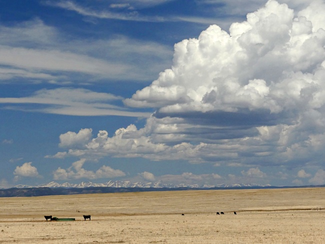 Sangre de Cristo Mountains in Colorado, from deep inside New Mexico Dayride with this point
as highest summit:
PARTIALLY PAVED / UNPAVED ( < Old Raton Pass | Bobcat Pass > ) Laughlin Peak - Blosser Gap Rd s(u) : Maxwell National Bird Refuge > Laughlin Peak Rd east > Blosser Gap Rd north > Laughlin Peak - Blosser Gap Rd s(u) > TO Ranch Rd north > Eagle Tail Rd north > US64 south > NM445 south > short dirt road detour in Maxwell National Bird Refuge > back to starting point: 66.2miles with 2040ft of climbing in 5:59hrs (garmin etrex30 m5:21.5.16) |

 The next turnoff
towards the left is the obvious choice for
better views of the landscape. Soon the
distant high part of the Sangre Cristo
Range, located across the state boundary in
Colorado make a far more impressive backdrop
to the landscape than from many closer
spots. But keep in mind, that the pictures
on this page were taken with an extreme
telephoto setting. My lens goes all the way
to 600mm, even if I did not zoom in quite
that much.
The next turnoff
towards the left is the obvious choice for
better views of the landscape. Soon the
distant high part of the Sangre Cristo
Range, located across the state boundary in
Colorado make a far more impressive backdrop
to the landscape than from many closer
spots. But keep in mind, that the pictures
on this page were taken with an extreme
telephoto setting. My lens goes all the way
to 600mm, even if I did not zoom in quite
that much.|
|
advertisement |
|
|
advertisement |