| |
| |
Monida Pass Marshall Spraque remarks in
the appendix of his book "the Great Gates"
about this pass: "low unexciting pass and
town", and I had to agree when I drove
over it once before this. But actually,
riding a bicycle over it again opened my
eyes to new aspects. There is actually a
separate, mostly paved road on the north
side you can follow. And the GDMBR seems
to get up the south side without setting
wheel on this four - lane road. On the
wide top you can also use a dirt road
crossing, parallel to the I15 Monida Pass.
It is about 80ft higher. But actually - the shoulder
of this 4 lane road is vastly preferable
to 99 percent of all paved Montana roads,
and about 1000 percent safer. There is
plenty of room to the right of the rumble
strips. This time the Montana highway
department has not gone out of its way to
make life as dangerous as possible for
cyclists. Also - the ride is actually
quieter, because there are no center
rumble strips. Traffic is relatively light
and unexpectedly considerate, often
passing a cyclist in the left lane. If the
rest of Montana roads were like this, it
would be a better world (and a more
bicycle friendly state too). In a way the
GDMBR pavement paranoia is understandable,
especially in Montana. But on Monida Pass
there is no need for it.
From
South. (described downwards) The
junction with the Red Rocks dirt road is
just of the summit. The GDMBR comes up the
southern approach to Monida Pass and then
continues on the Red Rocks Rd. It climbs a
little higher and then descends to to
picturesque abandoned farms in the
Centennial Valley. But more interesting in
my mind, is the view on this side of Monida
Pass: a dry, massive bare series of peaks
that make up this part of the Beaverhead
Range. The highest and most picturesque part
of the range seems to be in private hands of
a ranch. You have to get some miles in
to actually loose 300ft, on this gentle of
gentles passes. After pedaling for about 10
miles into the wind, the Snowline exit is
the first exit to fill this requirement.
Dayride with this point as
as highest summit
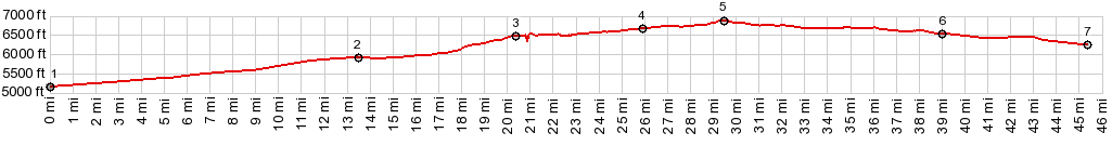
COMPLETELY PAVED ( < Sawtell Peak(ow) | Big Sheep Creek Divide/Medicine Lodge Pass > ) Monida Pass x2: I15 Spencer exit > I15 north > Old Hiway91, where it crosses to east side of I15 > Monida Pass << turnaround point Snowline exit > I15 south back to starting point: 50.6miles with 1700ft of climbing in 4:11hrs (garmin etrex30 r4:20.9.3 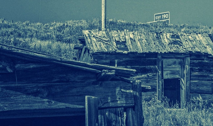 History The old town on top of the pass was a stage stop on the route from Salt Lake City to the Montana gold fields. It seems to have had no name at the time, even though it crossed the CD between Idaho and Montana. In 1880 the top was also a station on the Utah and Northern railroad. The train dispatcher stated using the name "Monida", combining the names from the two states. |
|
|
advertisement |
|
|
advertisement |