| |
| |
FR5621 Lake Como I'm guessing, somebody
really liked this lake and also Lake Como
in Italy. So somebody named this one after
the other. There is really not much
resemblance. But they are both beautiful
in their own way. One thing they have in
common is, that they are both surrounded
by some spectacular mountains.
From
South. The decent to the lake is a
little rocky for a gravel bike, but perfect
for my Mantra. Crossing the dam across the
lake is my favorite part of this ride. From
there a straight road through the forest
meets US93.
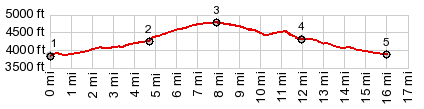
Dayride with this point
as highest summit:
( < Lost Trail Rd s(u) | Brushy Fork - Spruce Creek Divide > ) FR5621 Lake Como , additional out and back : a short distance up Lost Horse Road > down Lost Horse Road > up 5621 > FR5621 Lake Como s(u) > Lake Como > across Lake Como dam > down FR550 Rock Creek > down Lake Como Rd > US93 north > Darby <> out and back to end of Trapper Meadow Rd << Mt473 south << turnaround point at jct with Connor Cutoff > Leavens Rd north <> several out and backs to dead ends in real estate development areas around views of Trapper Peak << MT473 north > US93 north > Darby with sideroad detour > Old Darby Rd north > Sleeping Child Rd north > Skalkaho Rd north > US93 south > Lost Horse Rd west back to starting point: 64.3miles with 2650ft of climbing in 5:39hrs ( garmin etrex30 m3:20.7.12 Notes: a cool, comfortable and later-cloudy day after a way-too-hot day 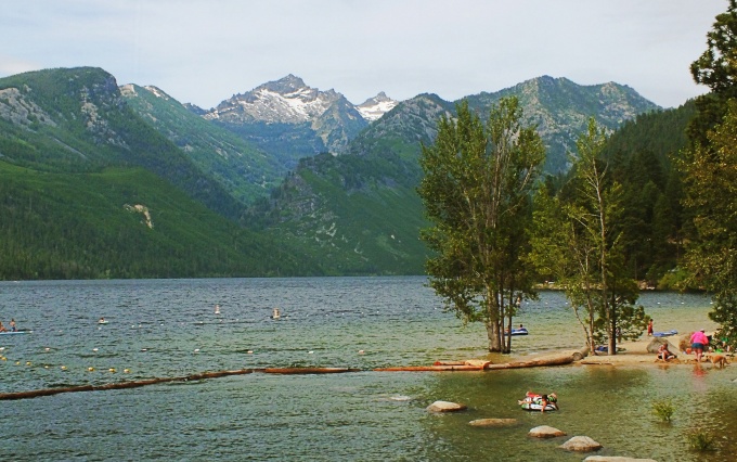 |
|
|
advertisement |
|
|
advertisement |