| |
| |
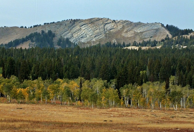
Franklin Basin Rd s(u) This summit follows the
drainage of Logan River in a north south
direction, cresting parallel to the Bear
River Range. By far the easiest access
road is from Utah, but the summit is in
Idaho.
The road follows along on a
subalpine meadow. At the top a few rock
outcrops to the west hint at the presence of
a fault range. There is no indication of
crossing the state line, but the top is in
Idaho. On both sides near the summit the
road surface is quite sandy. From
North. At a turnoff less than 300ft
below the summit, a dirt road to the east
crosses the higher Danish Pass.
Therefor Franklin Basin Rd is a shoulder
summit. Below this turnoff the road
alternates between a medium rough torn up
ATV trail and a mediocre dirt road. This
section down Hiyard Canyon is steeper and
rougher than anything else on the profile. From the jct with Cub River Rd
a good fast dirt road leads down the last 20
miles towards Preston and its rounded
breadloaf grasshills. The last several miles
are paved.
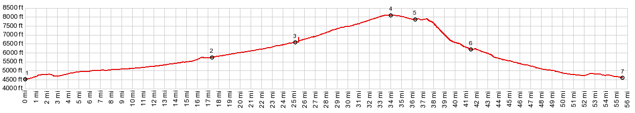
 Dayride with this point as highest summit: PARTIALLY PAVED / UNPAVED ( < FR147 Ephraim's Grave(sh) | Danish Pass > ) FR406 Franklin Basin Rd(sh) : a short distance up FR406 from its jct with Ut89 up Logan Canyon > up FRFranklin Basin Rd > FR406 Franklin Basin Rd(sh) <> short out and back up FR415 > down Hilyard Canyon Rd > down Cub River Rd > FR91 south > Franklin > Logan > up US89 Logan Canyon > back to starting point on FR406: 78.2miles with 4460ft of climbing in 6:33hrs (garmin etrex30 m3:20.9.18) Notes: at jct Cub River Rd - Ut91 I met Alan and Evelyn, the first real cyclists since the GDMBR,and the first people I could relate to since then, a missionary with a mission to boot. Thanks for the great conversation, and I hope someday there will be more. 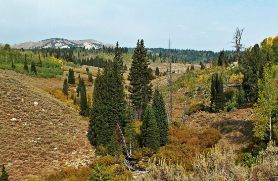 |
|
|
advertisement |
|
|
advertisement |