| |
| |
Brownlee Summit
Roads climb out of Hells Canyon
into opposite directions, into Oregon and into
Idaho, and they make an interesting comparison.
While Salt
Creek Summit in Oregon reaches over 6000ft,
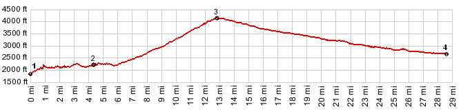
here on the Idaho side the road climbs to 4331ft
to reach a divide on Brownlee Summit. Over on the
Oregon side the scenery remains true to the
symbols on the license plates: trees, trees, trees
as far as the eye can see, as soon as you get away
from the river. Over here on the Idaho side,
curtain like grassy slopes reach much greater
heights, before the tree cover takes over.
During my visit in September there was very little traffic. But I think this area has the potential for heavy boat trailer traffic on the road.
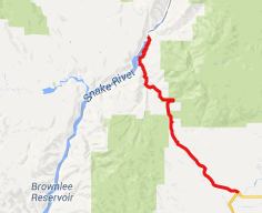
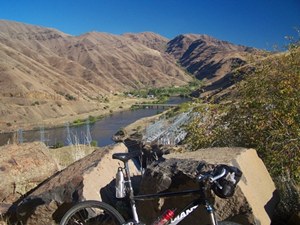
From West. Riding along the Snake River
can be many different things. Here in Hell Canyon
it means riding through a linear camping town
along a river with a heavily controlled flow,
grassy mountains rising thousands of feet above. But the relaxed riding without climbing ends at
the Brownlee Dam, and that's where the profile
starts. The first little climb just gets the road
to the top of the dam, and then the road continues
at water level again - now a lake. The character
of the road changes - now following curvacious
contours of artificial bays. I thought that this
passage along the lake was the most scenic part of
the ride. During the morning the folds in the
green hills are lit to perfection, making them
look like countless waves in curtain. Then during
late afternoon, frontal light makes the lake
appear like a reflector. But back to the climb. The road enters a narrow
canyon and it looks like the top can't be far
away. But that perception is quickly corrected
after the first 1000ft climb. On top there is far
view of mountains to the west in Oregon. The
summit has an elevation sign without a name. A few
unofficial signs in the area name the summit. 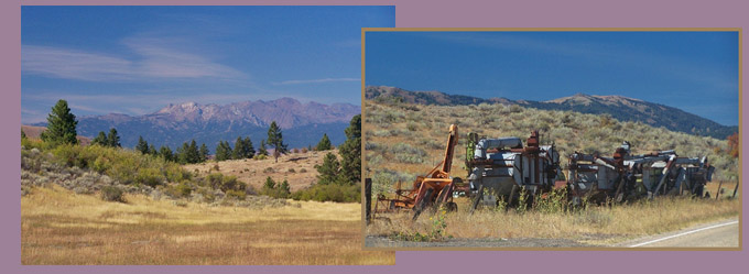
From East. (described downwards). This
quickly turns into a road through a generic
progression of sage brush hills, passing quickly
during a shallow downhill. An added bonus to the
ride is a regular procession of antique farming
equipment, all labeled, on a field next to the
road, just before entering Cambridge. "Population 300" reads the sign. 300 people can
be a considerable population in this part of the
west, where cartographers have sometimes bestowed
names onto imaginary or historical locations. This
is a real town with businesses, cafes and gas
stations. Actually, it seems to have quite a bit
more than 300 people. Just the school looks like
it could fit 400 students, and the two church
buildings seem worthy of a city congregation, one
for the baptists and one for the Mormons. I was told in town, the sign only gets updated
after a census, that is every 10 years, and even
that may have been forgotten a couple of times.
The pawn shop in town also seems to take pride in
the offensiveness of its anti Obama displays. But
this should not reflect on the town as a whole,
even though it probably does.
Dayride with tis point as highest summit: COMPLETELY PAVED: ( FR39
s(u) -2 on Salt Creek Summit page | Elba Pass > )
|
 Approaches
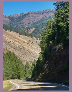
|
|
advertisement |
|
|
advertisement |