| |
| |
Passo Di Veccena This pass is on a big forested rolling altiplane. Geographically it is still part of the dolomites, and labeled Altiplano del Sette Communi on the map. There are many ways to the top from all possible directions, and the really hard and spectacular parts are al located on the lower sections, climbing the sheer limestone cliffs from the valley floors. There is a special relation
between the area at the top to the Val
Sugana area around Levico Terme. From the
top of the pass a not-so-long trail climbs
to the most prominent rock outcrop visible
from the valley in Levico. On top of this
landmark rock-outcrop sits a prominent old
military fort.
In Lavarone the route joins
SS349. There is a definite vacation feeling
to this town. Now the wide road hops short
distances from one tasty vacation town to
another. There are so many, that they don't
all fit on a 1 : 200 thousand map, and they
are not big. But they all seem to have a
town square in the center. During my ride in
late September all businesses were closed,
but the numerous groups of racing bikers
seemed to enjoy the area even more because
of it. The route goes over a pleasant
forested little intermediate summit (SS349
Lavarone via Sp313) and then comes to
a high meadow with an Inn. At the end of
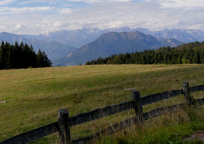
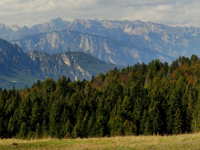
this meadow is the only far view of the
central dolomites that can be obtained from
along the paved road. A little more easy shallow
climbing and the road reaches Passo di
Veccena, a wide shallow grassy saddle with a
roundabout for three approaches. In addition
to the three road approaches, a narrow paved
track goes higher towards Cima Veccena. How
different this mountain looks from this
side. Trees reach almost to the top of a
shallow slope, with a pronounced,
but unremarkable rock outcrop at the top -
no hint of a 5000ft drop on the other side.
I only followed this paved track to a
shallow section below a cheese factory/ Inn,
from where it started decending again. But while this cheese factory
track is still in the forest a rocky old
military track starts from it, at a barely
noticeable junction. It goes up the fort,
that is so prominently visible from below.
It has a very rough section, paved with
large natural stones. For heavy military
equipment this must have been better than
drowning in the mud. But for cycling and
walking it is a different story. Even
electric mountain bikers think it is hard. I
tried walking it, and regretted not taking
along my hiking shoes. But the light and
weather deteriorated to a point where I
turned around, and so the description ends
here.
From
East. (described downwards) The
rolling summit meadow continues on this side
for several km. The top of Cima Veccena
remains a point of focus in the landscape.
That's really all I know about this side,
since I turned around for an out and back
ride. However - I did ride the lower
part of the profile in conjunction with
other shoulder summit points. So just a few
notes: The southern edge of this plateau has
many roads along it, forming numerable
shoulder points. The obvious route from
Asagio follows the main road along Sp71,
definitely not the best route because of
traffic, not even the shortest. Better to go
through Conco. Dayride with this point
as highest summit:
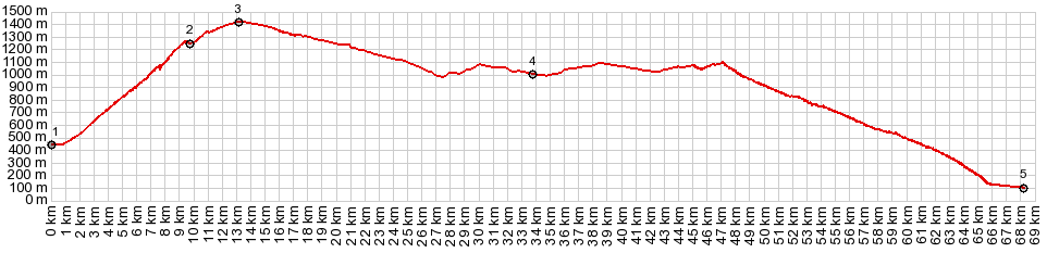
COMPLETELY PAVED ( < Passo Croce d'Aune | Passo dei Redebus > ) Passo di Veccena x2 , additonal out and back: Levico Terme > Calceranica al Lago > Campreghen > Pian del Pradi <> out and back to end of road in village >> Carbonare > SS349 west > Chiesa > Ghongi > Lavarone > SS349 Lavarone via SP133 (shp) > Passo di Veccena << turnaround point at Trento boundary ~330ft below summit > back to Passo di Veccena <> out and back on paved path toward cima Veccena >> SS349 east > down SP133 > back to starting point in Levico Terme with sightseeing detour: 48.7miles with 6240ft of climbing in 5:33hrs (garmin etrex30 r5:21.9.28). 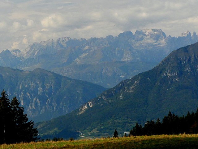 |
|
|
advertisement |
|
|
advertisement |