| |
| |
Col du Telegraphe
This pass feels like a shoulder
point to Col du
Galibier. But there is a 175m descent on the
west side, which is more than enough for a real
summit. Using unpaved roads on the other side of
the Valoirette Valley, you can make the approach
from this side yet larger. Even though this pass
often gets minor billing, when compared with what
comes afterwards - Telegraphe is the "lowely"
catgory 1, Galibier is the super "above" - hors
categorie, 50 percent of the total net elevation
gain between Saint Jean de Maurienne and the top
of Galibier belong to the Col du Telegraphe
approach.
Approaches
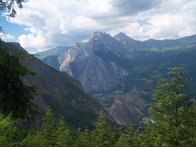
From West. (described downwards) A slight slope lets the bike roll downwards along a traverse over the Valoirette valley, its bottom disappearing below in a deep U shape. Across the valley a dirt road can be seen connecting villages on the others side of the gorge. I did not get a chance to try this. But it looks like this would make an interesting loop on a mountain bike, leading over an additional pass back down into the valley of the Arve. Historical Notes: The transmission towers on the Fort du Telegraphe are cleary visible from a large area. That is actually the reason that they are there. This is still an occupied military fort. But the location was first chosen as a prime spot to send messages with articulating arms on a signal tower. In 1809 this was state of the art communications, and much faster than the customary horse rider between Lyon and Milan. The fort was also in a second backup line of the
"Alpine Line" of defenses during WW2.
|
|
|
advertisement |
|
|
advertisement |