| |
| |
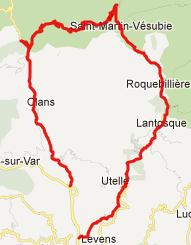
Col St Martin
Mountain passes,
running in an east-westerly direction, connect all
the high major canyon drainages north of Nice. Col
St Martin connects the Vesubie Canyon with the
Valley of the Tinee. It is interesting to compare
Col St Martin with the D32 Utelle summit,
which also crosses between these two drainages.
But the D32 summit does this further down stream,
just before they both merge into the Vars Valley.
Of course Col St Martin is a higher climb. Like
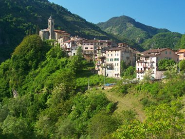
the D32 Utelle summit, the area below Col St
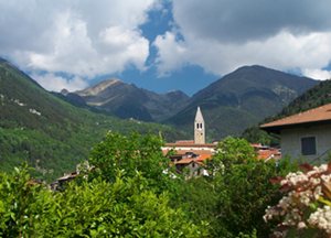
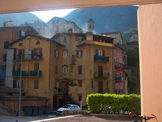
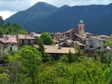
Martin is rich in medieval clustered towns. But
the first impression of Col St Martin involves ski
areas and modern condo high rises.
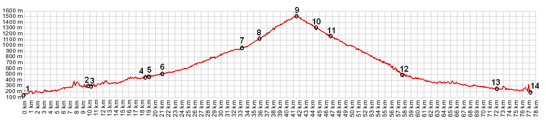
From East. The profile includes all of the Canyon de Vesubie as approach. It starts getting a little steeper somewhere around Lantosque. Other sources consider the approach of the pass to start in St Martin Vesubie. Once the road starts climbing past St Martin, three peaks over 3000 meters are in good view. They are Cime de Gelas, Mt Clapier 3045m and Cima de Brocan 3045m. When the road leads through the short tunnel the views disappear. On top there is a rondell, several high rise condo buildings, at least one restaurant, ski shop and lifts, a pony ride business and no views. From West. (described downwards) This
side is the quieter side of the two. The landscape
has a more pastoral, soothing effect too. The many
different parts of Valdeblore contain many hotels
and several gites. But I didn't check how open
they were. I also included the entire approach of
the Tinee valley in the profile. This side is
marked with signs directed towards cyclists,
marking "current altitude", "remaining altitude to
be climbed", and "average remaining slope"
statistics. The eastern side is not.
Dayride with this point as highest summit COMPLETELY PAVED Col St Martin x2: out and back ride from Lantosque <> St Martin in Vesubie <> Col St Martin <> turnaround point at 750m, maybe a km below turnoff to Rimples The last summit point with different start and end points on this Extended Tour is: D32 Utelle s(u)
towns along the
approaches to Col St Martin: back to Cycling Passes in Europe |
 Approaches
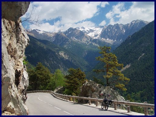
|
|
advertisement |
|
|
advertisement |