| |
| |
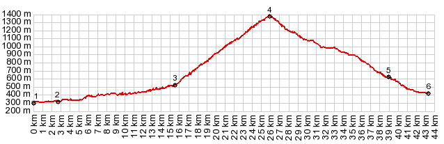
Col de Spandelles
Approaches
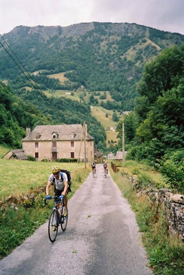
From North. The
turnoff from D226 at point 3 is signed. Otherwise
it would look like this little road is just going
end in the next backyard of one of the few old
stone houses near the bottom. Climbing back and
forth in a wooded bowl, the houses disappear
below. On the way to the top I see about as many
people hiking the road as driving a small car,
about 4 of each. They are outnumbered by the
cyclists. But there aren't many of them on this
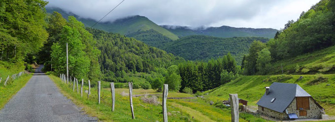
road either. The trees pull back numerous times to
open the view on the road meandering the width of
the valley below. I decide on a picnic lunch in an
unpaved turnout next to the road. A hiker wishes
me bon-appetit. The top is barely above treeline. The view is
only in one direction and limited by the adjacent
ridge. For lack of anything else the sign at the
top seems to get a lot of photographic attention.
From South. (described downwards) This road remains in the forest and has a more rolling character. There are no settlements next to the road, just a long roll through the forest. After a few km, a very rough unpaved track goes up to Col Coraduque. Then the road heads straight down the long valley. Open pastures become more common. In them sit old stone barns with large equilateral triangles for roofs. They are the punctuation in the landscape. Not until the road reaches the villages above Argeles-Gazost, do further signs of civilization return. The profile ends at a low point over the river La Gave de Pau, where the route connects to a long bike path through the length of the valley.
|
|
|
advertisement |
|
|
advertisement |