| |
| |
Puerto de Santa Barabara
The only thing I can say in defense
of my own pictures is this: They did contain a
slice of everyday reality. In the foreground was
my bicycle with disorderly packed bags and a
baquette sticking out of the saddle bag. It leans
on old stone road marker, that is left over from
an older highway construction. The viewpoints over
the top are really a progression of large dirt
parking lots. A wild yellow flowering bush was in
full bloom, providing yet more possibilities to
compose pictures.
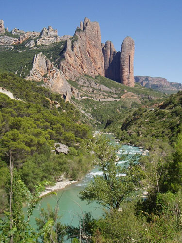
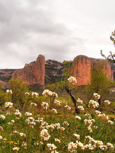
Approaches Muriillo de Gallego itself is a beehive of high
houses on the other side of the road. These
imposing canyon walls continue as the road stays
at the side of Rio Gallego and cuts through the
limestone range. A mining railroad has also
follows this course. The profile leaves the
railroad where it crosses the Embalse de la Pena.
The next stretch is a relaxing gentle climb
through the woods, without much excitement,
traffic or far views. Reaching the top the road breaks out of the
forest and reaches a series of far panorma points.
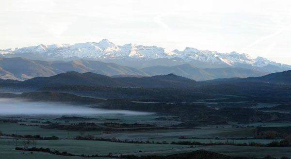
This side appears to be much drier is covered with
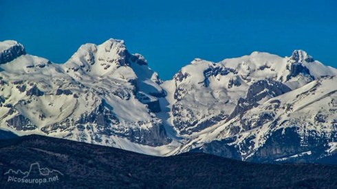
open fields before the white wall of the Pyreneen
main ridge is reached on the horizon.
From North. (described
downwards) A short descend leads to the village
that has played the middle ground it the last 45
minutes of photography: Bailo. This is actually
the steepest part of the whole ride. The profile
ends at another bridge, this time over the wide
Rio Aragon. On the other side of the bridge is
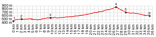
also a small vacation village with this name. A Day on a Tour with this Pass as highest summit: COMPLETELY PAVED ( < Via Verde Ojos Negros s(u) | Col de la Pierre Saint Martin > ) Puerte Santa Barbara: Huesca > Ayerbe > Murillos de Gallego > Puerto Santa Barbara > Puente de Reina de la Jaca > Berdun > Sigues > Salvatierra de Esca > Burgui > Isaba. Notes: gps data and mileage are on a computer that was stolen, but I do remember it was a very long day. In Isaba I met an English Hostal owner with whom I stayed for the next 5 days. Unfortunatly the contact data is lost too. Great room - directly opposite the nightly lit up church tower. There is one very well visited grocery in this village.
SLIDE SHOW2:
Rio Gallego Canyon section
|
|
|
advertisement |
|
|
advertisement |