|
|||||||||||||||||
|
|
|||||||||||||||||
| |
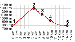
Col de Pontis
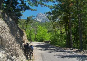
Much of what makes this little pass so attractive is the
lake below it. The road shortcuts across a ridge, to cut off
the area inside a "partial moon" shaped lake. -
Probably not the best description, but a look at the map
will explain. The little patched up road goes far above the
motorcycle caravans, though you can still hear them every
once in a while far below. The road below along the lake was
also used by the tour de France in 2005, under the name
"Cote de Demoiselles-coifees". You could never get
a such massive racing troop over this pass. But it's just
about perfect for a solo bikeride with sturdy tires.
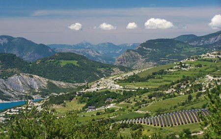
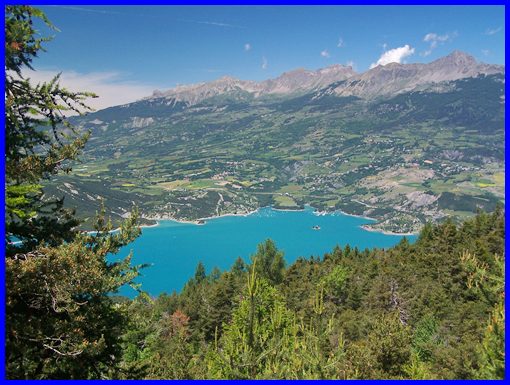
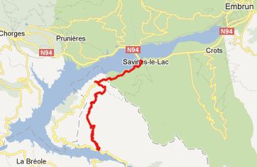
From South: The exit of the river Ubaye from the
mountains is quite impressive. Sofar paralleling the river, D954
forks off to the right and leads around the eastern side of Lac
de Serre Poncon. The road goes through two relatively short
tunnels, and then a sign to the right points up the exquisite
little cycling road to the Col de Pontis. This is where the
profile starts. The road climbs in miniature like switchbacks
above the badland topography of the undeveloped southern
shoreline of Lac de Serre Poncon. The end of the "Cirque de
Morgon" appears above, often perfectly framed by trees
hanging over the narrow road. Traffic is light, but it is too
easy to forget that there still are some cars on this narrow
path. The crest comes soon after a group of old houses. On top
stands a pass sign, along with an enticing sign pointing up
paved path, climbing higher, with the label "Cyclotourisme
brevet de 7 Cols Ubaye".
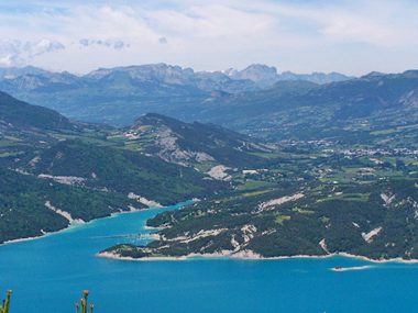
From North. (described downwards) But instead this
description now descends the pass. On the other side is the huge
Embrun Valley to the right, and the lake below now has a very
commercially developed shoreline. But from up here it all looks
very toy like. Just the mountains encircling the entire scene
appear too huge to be toylike. The road passes through the
village Pontis, which has a little park that is great for pique-nique
in the shade. The road now dives into a deep forest for a short
relaxation from summer heat. It is so dark in here, that it
takes a little time for the eyes to adjust. A little later the
road soon merges with the main road again, D954A. This time
D954A is also some distance above the lake, and the profile
descends along with it to the bridge in Savines-le-Lac
A Day on a Tour:
(<Col du Larche|Col
de Moissiere>)
Col de Moissiere , Col de Pontis: St Anne la Condamine > Barcelonnette > le Lauzet-Ubaye > Col de Pontis > Chorges > Col de Moissiere > Ancelle > St Leger les Melezes <> out and back 6km grocery shopping trip: 67.4 miles with 5530ft of climbing in 6:29hrs (VDO MC1.0 m4:12.5.9)
back to Cycling
Passes in Europe
|
 Approaches