| |
| |
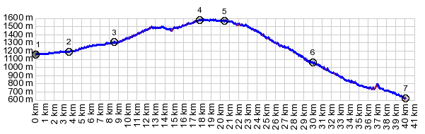
Col de la Perche
This is one of the main traffic
crossings between Prades in France and Puigcerda
in Spain. Traffic can be pretty heavy, but there
is also a good shoulder for the most part above
Olette. I saw several other cyclists along the
route. But alternatives exist, that are sometimes
not immediately apparent just from a casual glance
at the map. But the other routes do not follow
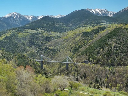
this fairly spectacular canyon route with a train,
with traction assistance, formidable climbing
competition for any bicycle.
The profile starts in Olette. The road climbs
together with the Tren Jaune out of the canyon.
The bridges and tunnels of the railline are an
added attraction to the scenery. Much of the rail
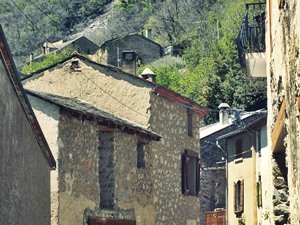
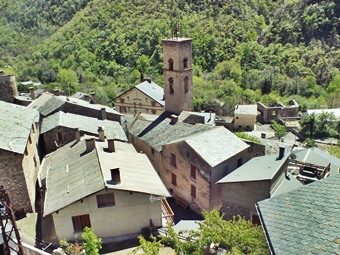
line can be seen from the road. Fontpedreuse hangs
by the hillside, its houses not having slipped off
the steep slope into the canyon below, since the
many hundred years it was built - to the best of
my knowledge. The road has an especially
interesting vantage point on this village from a
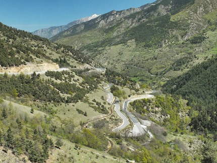
little above. Now the road is getting serious about getting out
of the canyon and onto the plateau. After a series
of switchbacks even the railroad with its traction
devices remain below, its tracks hanging above the
gorge with the help of an adventurous suspension
bridge. As the road gets to the top, it becomes clear that this is a broad rounded plateau like top, covered with many other summit points. It feels like the highest point of the road is right below the Mt Louis fort, part of the Maginot defensive line during WW2. However, checking the profile validates that Col de la Perche is actually the highest point, even if just by 20 meters. The pass itself is a busy spot. It contains a pass sign, surrounded by houses, businesses and traffic.
From East. (described downwards, moving left on the profile). Going down this side, there are several options that are more attractive on a bicycle than this main road. They include the Eyne summit and the ride through Bolquere, pictures and profile included in the Col de Mel page. But here are a few notes on the profiled route
along the main road anyway. N116 drops and crosses
Col Rigat, just a shoulder point. The Tren Jaune
runs immediately next to the road here, and enters
a short tunnel, signed with the pass. The last switchbacks down into Saillago have an
especially expansive overview of the trainline, so
that chances are best for actually seeing one of
these modern appearing, yet slowly crawling two
car trains.
A Dayride with this point as shoulder summit is on page: Col de Mel |
|
|
advertisement |
|
|
advertisement |