|
|||||||||||||||||
|
|
|||||||||||||||||
| |
|
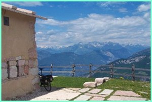
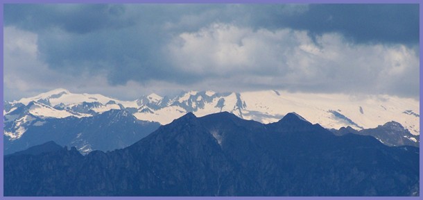
Monte Varagna s(u)
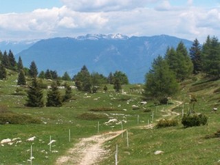
On one side this is a mostly paved climb to a refugio in a high
alpine meadow. On the other side a variety of unpaved roads and
single tracks are available. The refugio is not at the highest
point of the profile, but it has much better views, and you can
also order food, drink and sleep here.Most of my time at the refugio was spent gazing out over the scenery, and trying to figure out, just exactly what I was looking at. The views are of small rivers emerging from v shaped canyons. The Adige (Etsch) is just one of them. To the far north the main crest of the alps sets an icy limit to the extend of the world that can be surveyed from here.
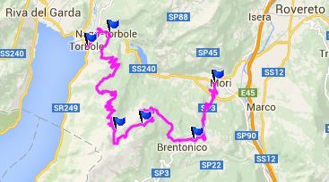
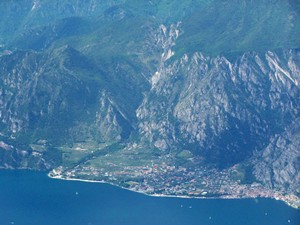
There are separate routes for the sometimes incredibly heavy
stop and go automobile traffic and the bike path between Torbole
and Passo Giovanni. The bike path deviates from the road near
the spot where the main road along the coast (coming from south
to north) is no longer adjacent to the water. The map follows
the road, but the path is a better route. Back to the top of Passo Giovanni and the town Nago: Here
signs point the route to Monte Baldo, wich refers to the entire
gigantic ridge along the east side of the lake. Following these
signs, the road gets very narrow, passes a Mother Mary statue or
two with flowers, and begins to climb through the forest. After
passing an especially inviting place to stop and worship, or
have a second breakfast, the road uses long steep ramps to work
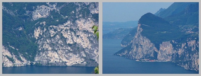
itself up the mountain, adjacent to a large limestone cliff. Now
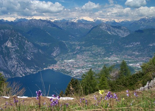
you can see the entire west shore of the lake, with its sweeping
cliffs and villages squeezing to the edges. Once the ridge
is climbed the road turns away from the lake and passes a few
vacation homes. Even up here people mow lawns and blow away
leaves with combustion energy and lots of noise. The road now
becomes intermittently non paved on the not ultra steep
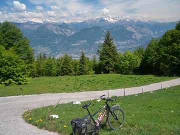
sections. The distant snow covered Ortler Group becomes more and
more the dominant mountain feature in the views. More
switchbacks follow, now completely unpaved, but always in the
forest. Finally the road crests, and opens a limited view
direction Rovereto. This is the highest spot, but the refugio is
still a little further.
The next dirt road goes in a northerly direction and quickly
reaches refugio Maiga Campei. This spot must have been chosen
for its overwhelming view to the north, the Ortler Group and an
even more snow covered crests to the west. I think most people continue to climb on single track from
here, via the trail behind the refugio, at least when the
weather allows this. But I descended on a very steep concrete
path to the north. It finally turns to dirt again, once it
becomes sufficiently not-so-steep, that dirt still has a chance
of staying on the slope and doesn't just slide off. My option
for the descent leads into the village Bretonico from above.
This attractive village is a world away from the traffic
nightmare of the lake and all its tourists circulating around
it. There are several ways to descend on wide smoothly paved
roads at high speed from here. The profile picks the option
towards the north and Tierno. There is a great bike path between
Rovereto and Torbole back up to Passo Giovanni, but that's not
part of the profile.
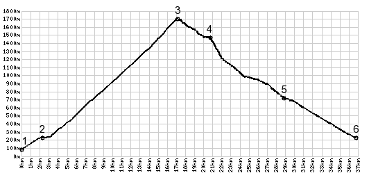
Dayride with this point as highest summit: PARTIALLY PAVED / UNPAVED Monte Varagna s(u) : Villa Emma, Torbole > Nago
> up west side of M Baldo as described > Mt Varagna s(u)
> Bretonico > Passo Giovanni(shp) <> grocery
shopping trip in Torbole >> back to starting point:
36.9miles with 6884ft of climbing in 5:37hrs (Garmin etrex30
m4:14.6.1) The last day with different start and end points is on page: Passo
Lagostrello
|
|
|
advertisement |
|
|
advertisement |