| |
| |
Kreuzbergpass
(aka pso. di M Croce Comelico) Kreuzbergpass has a very different character on each side. The east side up the valle Padola and S Stefano has a traditional southern feel to it and involves considerable climbing. The western approach goes through modern ski resorts that have a more sterile feel to them. Although there is not much climbing involved from Innichen (S Candido), far views of the most popular dolomite peaks make this approach interesting. Approaches From East. A whole series of
picturesque villages make this approach
interesting. Soon after leaving S Stefano, the
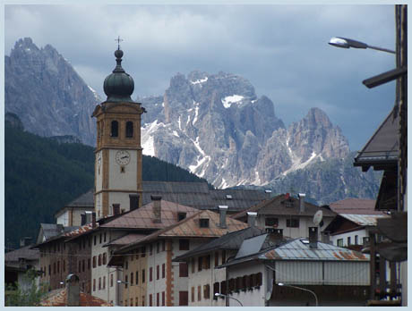
first one comes into view. The eye is focused by a
church tower up on a bare hillside slope. The
village clusters around it. The road turns right
into a side valley and the eye searches the slopes
above for a possible pass. But it's much too early
for that and the road soon turns back in the next
switchback, now focusing attention of a range of
sharp dolomite peaks behind S Stefano. The next
two villages are very linear affairs. They seem to
line the road, even though there really is very
little room between the road and precipice below.
Meanwhile the road has resumed its north westerly
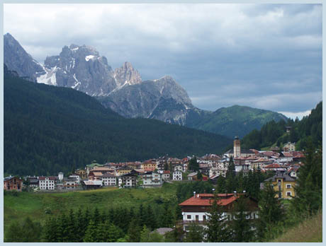
course. Choosing a very selective view of field
(like in pic 1) Padola has an almost medieval
appearance, while cycling through it. Now the
villages end and still quite a climb remains
through forest to the summit of the road and the
base of dolomite towers.
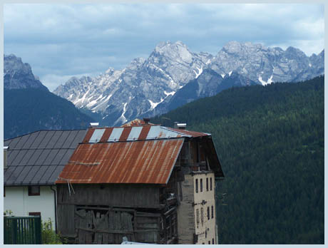
From South. After an extended roll, which
is really not very steep, when compared to most
passes in the dolomites, the road reaches S
Guiseppe, a ski circus town, which also has
incredible views of a whole series of dolomite
peaks in the Sesto Group, including the Drei
Zinnen, which stick up like three remaining
fingers from a hand. From here it's a gentle ride
down to Innichen (S Candido). Irregardless of
which way you turn here, left to Toblach, or
further downhill to Lienz, a meticulously paved
bike path is perfect for skinny tire bikes. A Dayride with this pass
as intermediate summit is on page: Tilliacher Joch.
The last day with different start and end points on this Extended Tour is on page: Ploeckenpass
|
|||||||||||||||||||||||||||||||||||
|
|
advertisement |
|
|
advertisement |