| |
| |
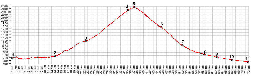
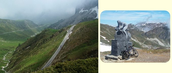
Colle Fauniera
aka Colle dei Morti I think this pass is
on a lot of favorites lists and it's easy to see
why. It is a fairly rough and very narrow curvy
road in most place. It stays above treeline for a
long time. I was very lucky when I crossed it.
Snow still closed the top. But with a mountain
bike and a few short portages you could get over
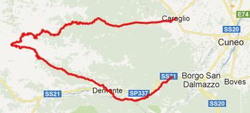
it. The option profiled here connects the Valle
Stura Valley with the Valle Grana. But there is
also an option to connect to the Valle Maira over
a different pass. Since all these valleys drain to
the east, the ends are easy to connect and this
makes for a perfect day loop ride. Judging from
all the riders I saw on a Saturday, I think that
most people do the loop in the opposite direction
as I describe it. My map showed the name Colle
Valcavera at this location, which is another
nearby pass.
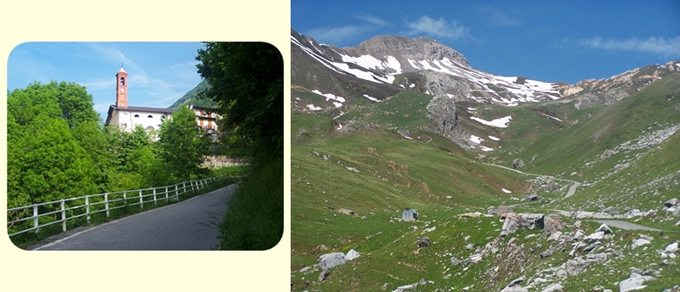
From South. The turnoff in Demonte says
"San Giacomo" and often has a "chiuso" sign. But
people in town riding bicycles assured me this
doesn't mean much. The road climbs through a few
small settlements in the valley, grouped around
church towers.
From North. (described downwards) While
the southern approach was completely clear, clouds
were drifting up the Grana Valley. This approach
had far more traffic, bicycles and also a few
motorcycles and cars. The road surface is quite a
bit rougher too. This would explain why the upward
bound cycling traffic was heavier on this side.
They want to take advantage of the faster descent
on the south side. The road widens past
Castelmango, after it passes a collapsing medieval
village. Soon you are speeding along in a green
gorge on a road of regular width, heading straight
down the Grana Valley.
Dayride with this point as highest summit: Colle Fauniera/Colle dei Morti: Demonte > S. Giacomo > Colle Fauniera/Colle dei Morti > Castelmango > down Grana Valley > Valgrana > Caraglio > Cervesca > Borgo S. Dalmazzo > sp: 60.3miles with 5670ft ft of climbing in 5:57hrs (VDO MC1.0 m4:12.6.2). Notes: includes a shopping trip and a few extra miles around Borgo S Dalmazzo The last pass ride with different start and endpoints on this Extended Tour is: Col du Tende
back to Cycling Passes in Europe |
 Approaches
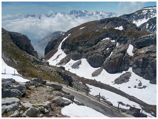
|
|
advertisement |
|
|
advertisement |