Alto de Castro Filabres
The remote little road over this
summit in the foothills of the Sierra Filabres, is
the missing link in a popular and wonderful day
loop over Puerto
Velefique and Collado
Venta Luisa. It is the lowest of the
three, but arguably the most charming. This road
is a paradox. It has the most unexpectedly smooth
surface (at least in 2016) and more twists and
bends than any driver would reasonably put up
with. - just about perfect for a great ride, with
or without Velefique.
| I have used the pictures of
panoramio and flickr contributors, as well
as other web sites to illustrate this page.
There are copyright notices and links
to all original pictures. My own pictures
were on a computer, that was stolen at the
train station Frankfurt Airport (model Acer
Aspire One (serial# NUSGPAA01625101C947600F) |
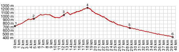 |
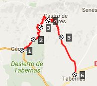
1.(,00.0730m)
START-END EAST: A1178 heads for the hills,
just west of Gergal
2.(04.7km,0940m)route stays right, left
goes to Venta Luisa
3.(12.1km,1040m)lower turnoff to Olula de
Castro
4.(17.9km,1250m)TOP
5.(28.2km,690m)START-END WEST: left goes
to Velefique, but profile continues down
to the right
6.(39.0km,0420m)START-END WEST ALT:
Tabernas
|
 Approaches Approaches
From East. After leaving
Gergal on A1178 the road starts climbing right
away. Soon after the junction with the road to Venta Luisa,
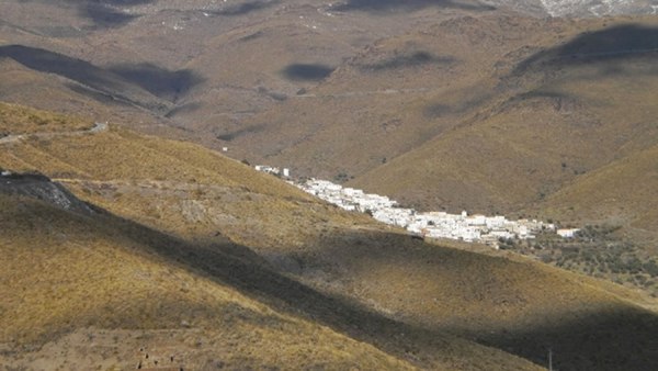
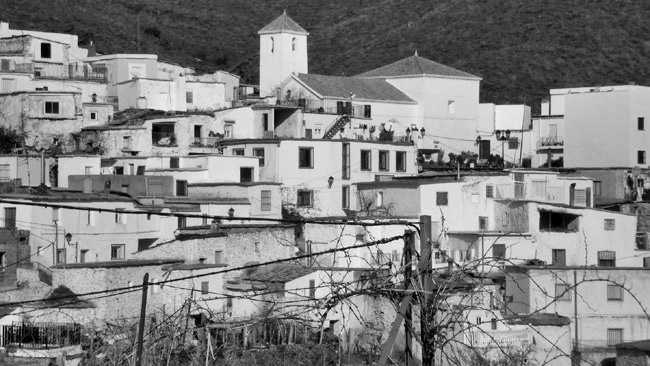
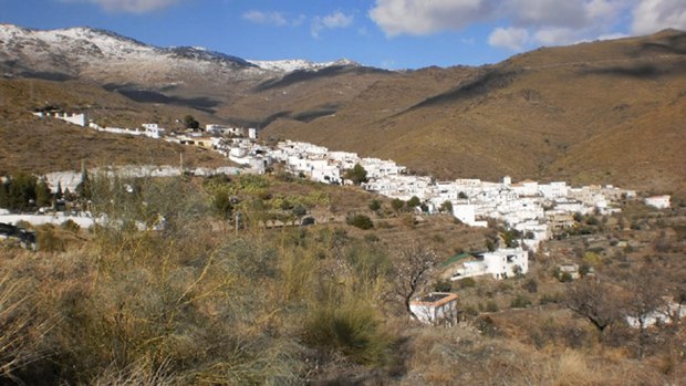
the trees become sparse and Olula de Castro
appears. The road remains above this white housing
conglomerate, so that from most angles it appears
to be sheltering in a crack of the green dessert.
Behind it the bare mountains are capped with a
solid wall of clouds, leaving it open to the
imagination what lies above. The pictures I can
find have clearer weather
The road encircles Castro de Olula showing it
from every angle with every background. At the top
the road crosses a low outlying ridge of the
Sierra Filabres and presents a new panorama on the
west side.
From West. (described
downwards) No trees divert from the panorama. The
landforms remind me of a gaint tiretrack
impression made from dried, caked mud. The road
seems to joyfully swing its way down this side,
not with tight switchbacks, but with wide endless
meanders.
A Dayride with this point as intermediate
summit is on page: Puerto de Velefique
|
|
| cLiCk on image , arrows ,
or thumbnails to advance slideshow |
|