| |
| |
Col des Ausines
This pass is only about 610 meters
high, but on top of this unobstructed windy
plateau that is more than enough for far reaching
views. Across, in the Massif de Canigou, you need
about twice that elevation to have a chance to get
above the trees. This summit can be incorporated
into many different loop rides, partly because
three roads meet at the summit.
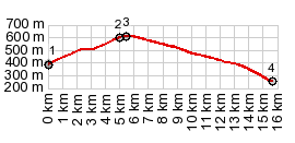
Two stone bridges crossing a creek at this point:
a new one, and a picturesque, still
functional looking old stone arch bridge. The road
in the proifle leaves the valley immediately and
climbs the rounded shrub forest ridge in a long
traverse. Three roads meet on the top. The one heading
south towards Vinca climbs about 10-15
meters higher. But I will still call this one
summit point
From South. A long
traverse along a gentle bowl leads the narrow,
peaceful road down into the valley. In Tarerach I
am greeted by a metal sculture of a high wheeling
bicycle rider. He is much higher than the road is
wide. Electing to go the direct way down direction
Finca, there is a last fine view of the Massif du
Canigou with Finca in the foreground. 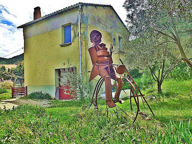 A Dayride with this point as intermediate summit is on page: Col de Roque Jalere 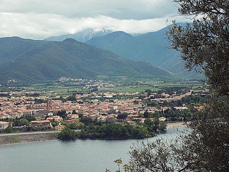 |
|
|
advertisement |
|
|
advertisement |