< Left Panel   Passes in French Alps   Areas   Tables   Maps   All Favorites  
Main Panel:   Main Page   Map+Profile   Alps Map  


Col d'Arces

When I first saw this name "Arces", I misread Acres, a word that makes sense to somebody like me, who barely knows enough French to get by on bike tour. Instead the name comes from a nearby village. But "acres" does describe the pass to point.  Ample fields, cows and acres are encountered on the north side, and on the top is a portable milking machine and a tank with organic fertilizing fluid. You don't have to look for it, you can smell it.

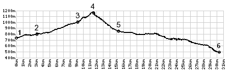
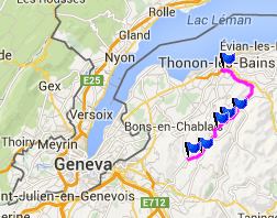
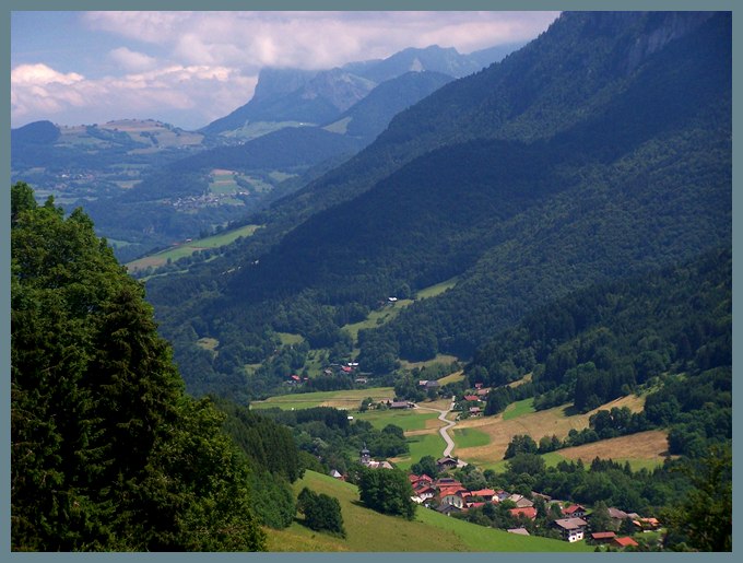
Actually - this turned out to be one of the most scenic rides south of Geneva. The pass connects the foothill valleys Vallee Verte and Vallee du Brevon. But it is much steeper and more remote than the direct Col du Terramont, which is just a shallow hill. Crossing Col d'Arces, the scene changes drastically from the rounded aunt hills next to Lake Geneva to more alpine landforms.

1.(730m,00.0km) START-END SOUTH: Boëge
2.(790m,03.1km)Villard
3.(1000m,09.3km)route turns right off D12 after Le Vernay
4.(1164m,11.4km)TOP: Col des Arces
5.(850m,15.2km)START-END NORTH: road on left goes to Col du Feu
6.(490m,32.2km)START-END NORTH ALT: D26, south of Thonon-Les-Bains

Approaches

From North.
Going up the Valle Verte, a narrow, rough paved road takes off to the east a few km north of Habere-Poche. There are actually a few cars on this narrow country bumpkin lane. But from a perfectly situated picnic bench on a freshly, mowed field I count more cyclists going up than cars. All the cyclists seem to be having an especially good time. But with sunshine after 8 consecutive days of rain, how could you not ? There are several crucifixes with especially primitively engaging facial expressions along the way to the top. There are really only two curves in the road. But judging from  the view as you go over the top, you would have expected quite a few more.

From South.
(described downwards) The town Lulin below is a hub for many of these attactive, small pass roads. And encircling the town like a rim are also an unnamed summit or two. The profile goes down to this village and continues along the valley floor all the way to Thonon-les-Bains, close to the shore of Lake Geneva

A Dayride with this point as intermediate summit is on page: Col d'Ajon


advertisement

advertisement