| |
| |
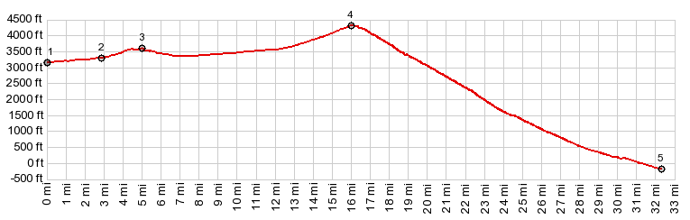
Daylight Pass If ever there is such a thing as
an extremely lopsided pass - this is it. And
the -260ft as a starting elvation on the "big
side" of the pass, obviously also has to be a
record. No surprise then, that the good points
of each approach are of also very different.
The west side has its incredible mountain
views and desert bottoms glistening in the
heat. The west side has bearable
tempereatures, at least in a relative sense,
and in the morning, according to the time of
year.
In Beatty things become pleasant.
A short climb up leads up pleasing, gentle
desert hills. A road cut at a small high point
throws the view open onto the quintessential
Nevada highway view, a road straight as an arrow
running head long into the the next range,
dressed to the waste in a wide skirt of
alluvium. There is no shoulder, no rumble
strips, no curves, no traffic to speak of, just
beautiful desert stretching out from range to
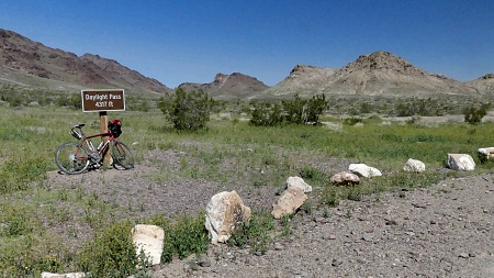
shining range. The summit in these desert hills
is quickly reached and has a sign with name and
elevation, and a nice view back into the
direction just traveled. And yes - the last few
miles contain gentle curves. 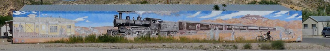 Beatty
The junction of the two roads,
Hell's Gate, marks a transition. The profile
enters a fairly steeply climbing, yet grassy
curvy valley. There is a tendency to
underestimate the elevation gain from the valley
floor to Hell's Gate. With 2700ft above the
-260ft low point, it is aproximately 2/3rds of
the total climb up. From here the April
temperatures also become more bearable. Traffic
on this road is very light, compared to the road
running through the famous valley.
Dayride with this point as
highest summit
( < Mormon Pass | Secret Pass > ) Daylight Pass x2: ~1mile south of Beatty on I95 > I95 north > Beatty > Nv374 west > Daylight Pass > C190 south > Beatty Rd north > Daylight Pass > Nv374 north > Beatty > back south on I95 to starting point: 68,1miles with 6120ft of climbing in 6:31 hrs (garmin etrex32 r4:23.4.23) Notes: first ride after the truck was towed into Pahrump and spent 3 days in the repair shop. Nice temperatures going down into Death Valley, fairly hot climbing back out of it. 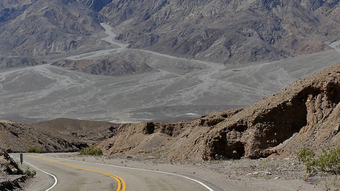 |
|
|
advertisement |
|
|
advertisement |