|
|
|
content
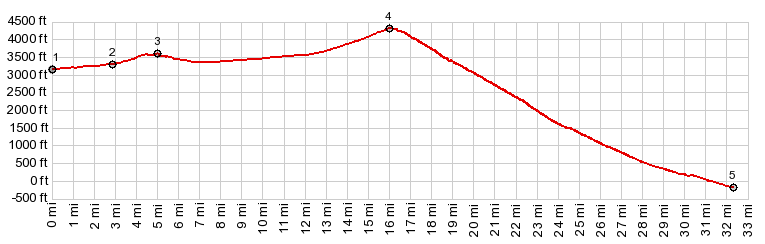
1.START-END NORTH:jct with Airport Rd,
just south of Beatty
2.profile turns left in Beatty
3.intermediate high point, 3580ft
4.TOP: Daylight Pass, 4316ft
5.Hell's Gate
6.START-END SOUTH:jct Beatty Road - Nv374
|