| |
| |
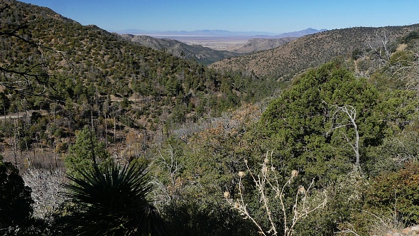
Onion Saddle Coronado National Forest is
comprised of roughly a dozen physically
separated sections. These island-like sections
are filled with more or less towering
mountains above the dessert. One of these
areas are the Chiricahua Mountains. The out
and back from the top of this saddle is a
great vantage point to get an overview on this
fascinating land of dense forests and fluted
rock formations over the dessert.
 From East. (described
downwards) Looking at the elevation profile on
this side, I now realize I really only rode a
small part of this approach on this side.
Instead my day consisted mainly of exploring the
higher out-and-back on FR42D. Unfortunately I
don't see a way to come up with a loop in this
area, even if the map seems to hold promises. On
this side the road turns towards Sulphur Peak
and its fluted rock formations. This view is
especially good in late light. 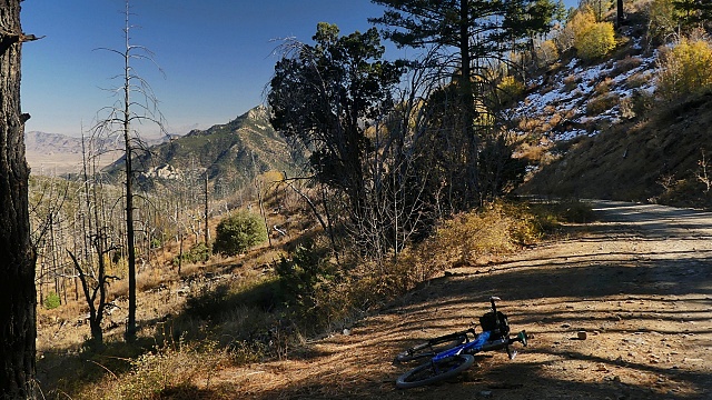
Out and back to end of FR42D Great views wait on the next 500ft of climbing. This road forks again with choices to Rustler Park and Bafoot Park. Rustler Park is a NF campground. A few steps behind passes the crest trail, and just a few steps on it, with the parked bike still in view, deliver a vast view in at least 270 degrees. The map shows this road climbing another 500ft from here, but if it exists, I missed it in the snow and mud. Slideshow of FR42D out and back
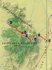
Dayride with this point as
highest summit:
COMPLETELY UNPAVED: ( < Heliograph Peak(ow) | Massai Point(ow) > ) Onion Saddle x2 : FR42 west side ~5630ft > FR42 east > Onion Saddle <> out and back on FR42D to Rustler Park camground <> separate out and back from FR42D to high point on spur to Barfoot Park >> back to Onion Saddle <> out and back down FR42 east side with turnaround point at 6920ft >> back down west side of FR42 to starting point: 26.2miles with 3820ft of climbing in 4:32hrs (garmin etrex32x m6:24.11.13). |

|
|
advertisement |
|
|
advertisement |