| |
| |
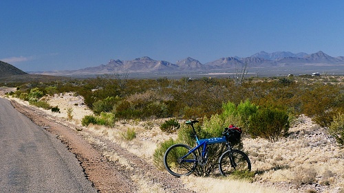
Middlemarch Pass This is a pleasant, fairly low
dessert gravel pass over the Dragoon Mountains
east of Tombstone. It can be part of a great
all-surface loop ride that also includes a
paved summit with so little traffic, it could
be gravel too.
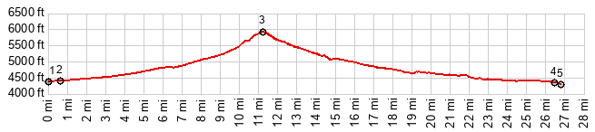
 From North.
(described downwards). The bouncing turns
and decends from the top are pleasant. But the
Dragoon Mountains do not show off their
precipitous rocky faces until the road is
further down, where it seems to parallel the
range for a short distance. After this the route
becomes a fast wide super highway, that just
happens to be nonpaved. In spite of that - no
traffic. The profile ends at a low point just
before the junction withh Az80, immediately
north of Tombstone
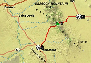
Dayride with this point as
highest summit:
PARTIALLY PAVED / UNPAVED ( < Massai Point(ow) | Montezuma Pass > ) Middlemarch Pass , Gleeson Rd s(u) : FR345 Middlemarch Rd, NF boundary west of Pearce > FR345 west > Middlemarch Pass > Az80 south > Tombstone > Gleeson Rd east > N Ghost Town Trail[a road] north > S Ghost Town Tral north > Pearce > FR345 back to starting point: 59.3miles with 3790ft of climbing in 5:47 (garmin etrex32x m6:24:11.15). |
|
|
advertisement |
|
|
advertisement |