| |
| |
Webster Pass
Webster Pass is the steepest
alpine jeep trail crossing in the Front Range. It
still pales in comparison to Argentine Pass. But
that is not a through going double track. Webster
Pass is roughly 100 feet higher than adjacent
Loveland Pass, but lower than Trail Ridge Road,
Fall River Pass and Jones Pass to the north.
From North. When cycling Webster Pass
from Keystone the world around changes
dramatically. Cookie cutter ski resort condos
disappear. Log cabins and signs of historic mining
activity take their place. Soon after they too
disappear below and the road enters its extensive
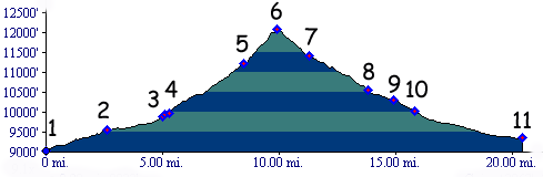
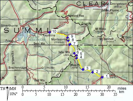
above treeline portion. Dayride with this point as highest summit PARTLY PAVED/ UNPAVED: Webster Pass , Georgia
Pass, Kenosha
Pass: jct Co - Swan Rd, north of
Breckenridge > up Swan Rd > Georgia Pass
> US285 north > Kenosha Pass > Webster
> Webster Pass > Montezuma > Keystone
> back to starting point on Swan Rd:
65.3miles (mech Odo m1:86.8.17 dr6_25-40) A Dayride with this point as intermediate
summit is on page: Argentine Pass
(dr8_32-42) History
In 1878 the Webster Brothers build a road over
what was called Handcart Pass. While not as
ambitious a shortcut as Argentine Pass, it was at
least shoreter than the route over Georgia and
Kenosha Pass crossings. At this time a new mining boom got under way,
making Leadville the center of roadbuilding
attention. This meant the mighty ridge of the
continental divide would be on the receiving end
of more elaborate road building attempts. But
that's really the start of another thread, the
Leadville Period. 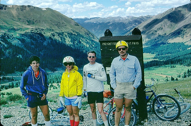 Cycling. An early mountain biking guide, first published in 1987, when moutain bikes had no suspension whatsoever and "gravel biking" was not yet invented (but practiced), describes an out and back ride from Montezuma to Webster Pass as "ride rating: strenuous, skill level: intermediate, and aproximate ride time: 3 hours".(William L. Stoehr's: Bicycling the Backcountry).
|
 Approaches
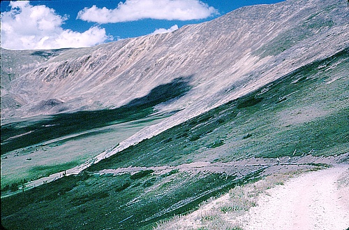 Colorado
Gold Rush of 1859/60 (
Colorado
Gold Rush of 1859/60 (|
|
advertisement |
|
|
advertisement |